
North Cascades Fall Larch Season Itinerary: 3 Days Among Golden Needles
There’s something truly magical about hiking through alpine meadows glowing gold, with jagged mountain peaks rising all around you. That’s larch season in the North Cascades — and it’s absolutely worth planning a trip around. Whether you’ve been eyeing October on your calendar for months or you’re suddenly free for a last-minute fall weekend, this North Cascades larch itinerary will help you make the most of this short, spectacular season.
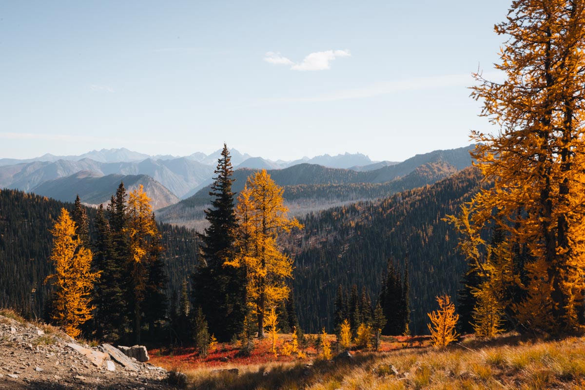
Unlike most fall color, alpine larches don’t light up the valleys. They grow high in the mountains — typically between 5,000 and 7,000 feet — and for a brief two-week window each fall (usually in early October), they turn a brilliant golden yellow before dropping their needles for winter. It’s one of the most beautiful and fleeting natural displays in Washington.
The tricky part? Larch season is short, unpredictable, and wildly popular. Peak color shifts every year depending on weather and elevation, and weekends can get busy fast (think full parking lots by 6am). Without a little planning, it’s easy to spend more time circling trailheads than soaking in golden views.
That’s where this 3-day itinerary comes in. It highlights the best larch hikes in the North Cascades, along with realistic tips for timing, parking, and backup plans. Each day includes one “core hike,” plus optional add-ons if you’re feeling ambitious and want even more alpine magic.
🚗 Getting There & Critical Logistics
Drive times: Seattle to Mazama is 3.5–4 hours. Spokane is 4 hours. It helps to plan for an early start or arrive the night before.
Last gas and supplies: Marblemount (west side) or Winthrop (east side). The Mazama Store has gas + limited groceries and closes early — don’t count on it for dinner supplies.
Northwest Forest Pass required: $5 day pass or $30 annual pass needed at all trailheads. Buy at ranger stations, some gas stations in Winthrop/Mazama, or online at Recreation.gov.
Highway 20 winter closure: The North Cascades Highway typically closes for winter in mid-November (sometimes earlier with heavy snow). If you’re planning a late-October trip, confirm the highway is still open. If not, here are some great winter hikes in Washington to keep you exploring.
No cell service: Expect zero reception along most of Highway 20 between Marblemount and Winthrop. Download offline maps, tell someone your plans, or consider a satellite communicator for emergencies.
Leave No Trace during larch madness: Please stay on trail — alpine meadows are fragile and take decades to recover. Don’t create new paths for photos. Pack out everything. Yield to uphill hikers on crowded trails.
Driving times between trailheads: Blue Lake to Maple Pass is 30 minutes. Maple Pass to Cutthroat Pass (via Cutthroat Lake) is 15 minutes.
🍂 When to Go: Timing Larches by Elevation
“Late September to early October” isn’t specific enough to plan around. Different elevations peak at different times, sometimes two weeks apart. But it varies year to year so make sure to check trip reports, Here’s a guide based on historical data:
High Elevation (6,500–7,500 ft)
Peak: Late Sept – Oct 12
Trails: Maple Pass Loop, Cutthroat Pass, Easy Pass
These turn earliest and often start dropping needles by mid-October.
Mid Elevation (5,500–6,500 ft)
Peak: Oct 1 – Oct 15
Trails: Blue Lake, Cutthroat Lake, lower Cascade Pass approach
Best bet if you’re visiting during the first two weeks of October.
The Sweet Spot
Oct 1 – Oct 12 typically gives you a shot at catching multiple elevations at once — but it’s also the busiest period of the year on Highway 20 trails.
How to Track Current Conditions
- WTA + AllTrails Trip Reports: Filter by date for recent photos. Note that reports typically lag 1–3 days behind current conditions.
- Instagram tags: #maplepasslarches #cutthroatpasslarches #bluelakelarches (often more current than trip reports during rapidly changing conditions)
- Ranger stations: Methow Valley Ranger Station or North Cascades Visitor Center can often give you really up to date conditions.
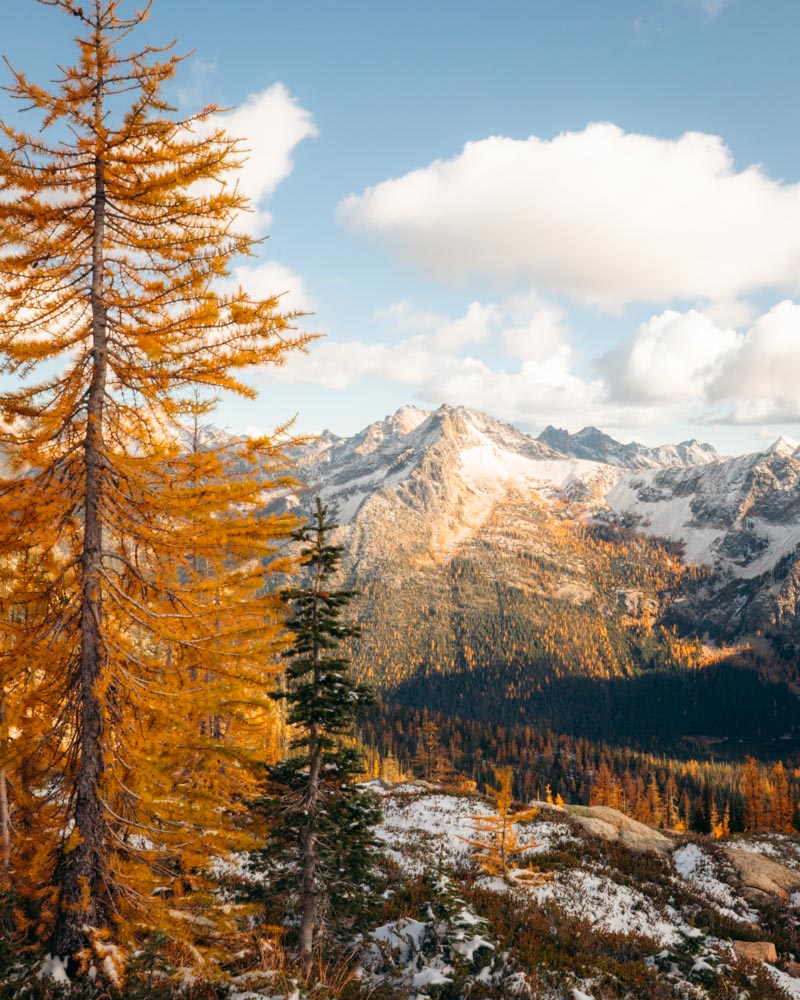
Weather in the alpine can change fast. By late September, trailheads might still hit 70°F (21°C), while early October mornings at the pass can drop to around 25°F (-4°C). You could start the hike in shorts and finish the day in winter layers.
Plan for temperature swings of up to 40°F (22°C), and pack layers accordingly.
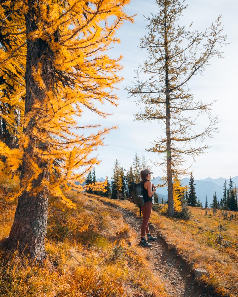
The 3-Day Larch Itinerary
Each day is built around one must-do trail. Then, if you’ve still got energy (and daylight), I’ll give you optional add-ons to stretch your adventure further.
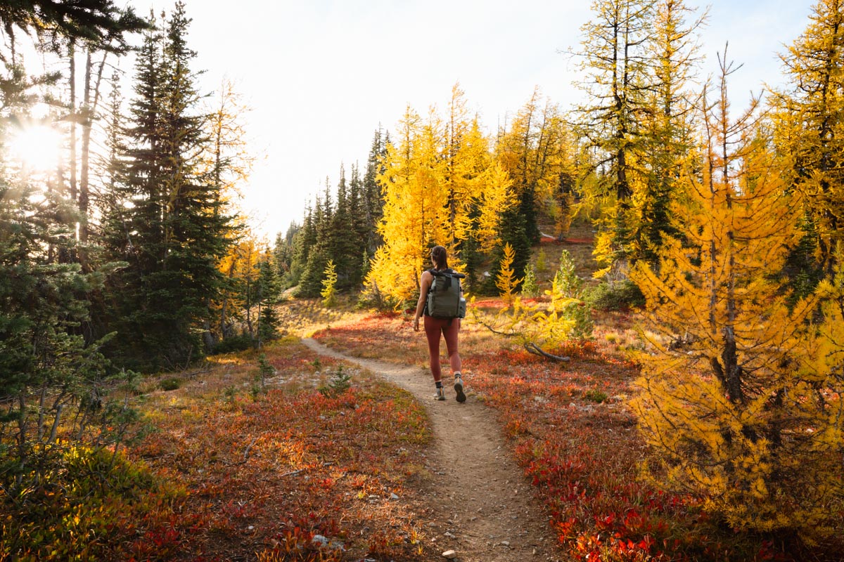
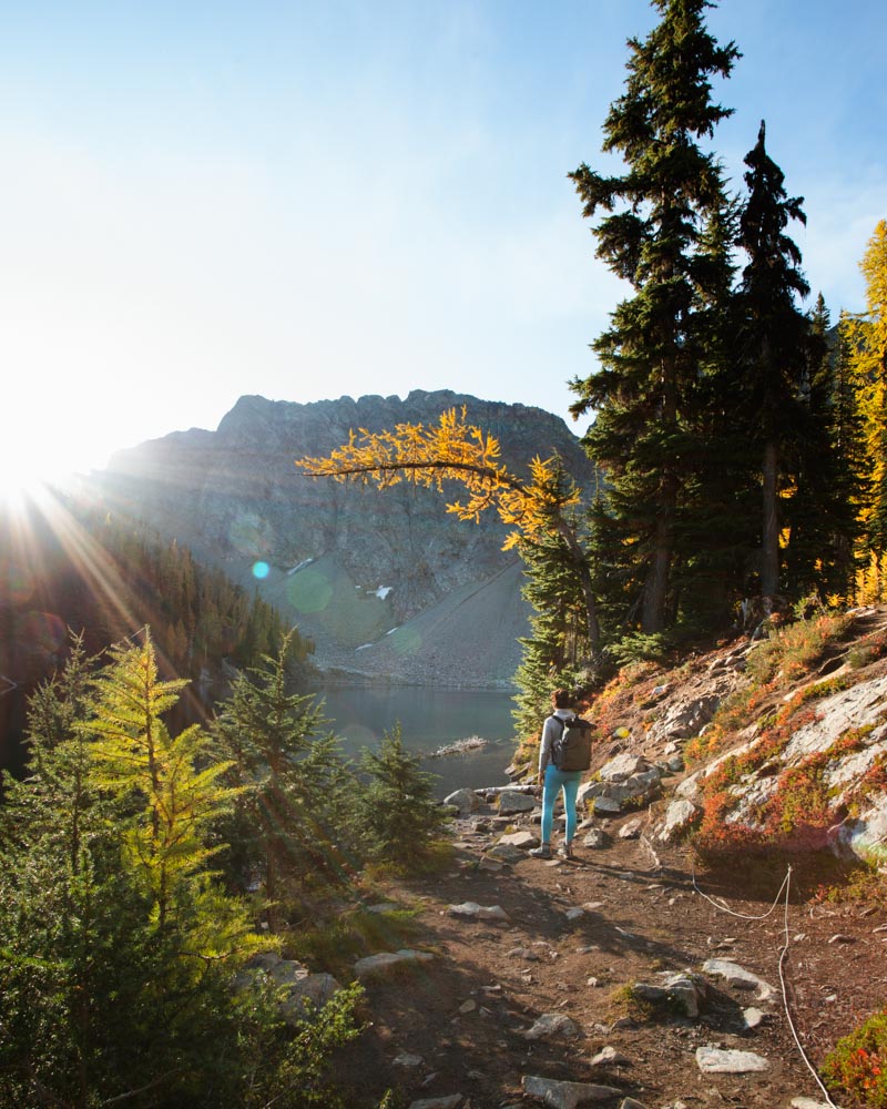
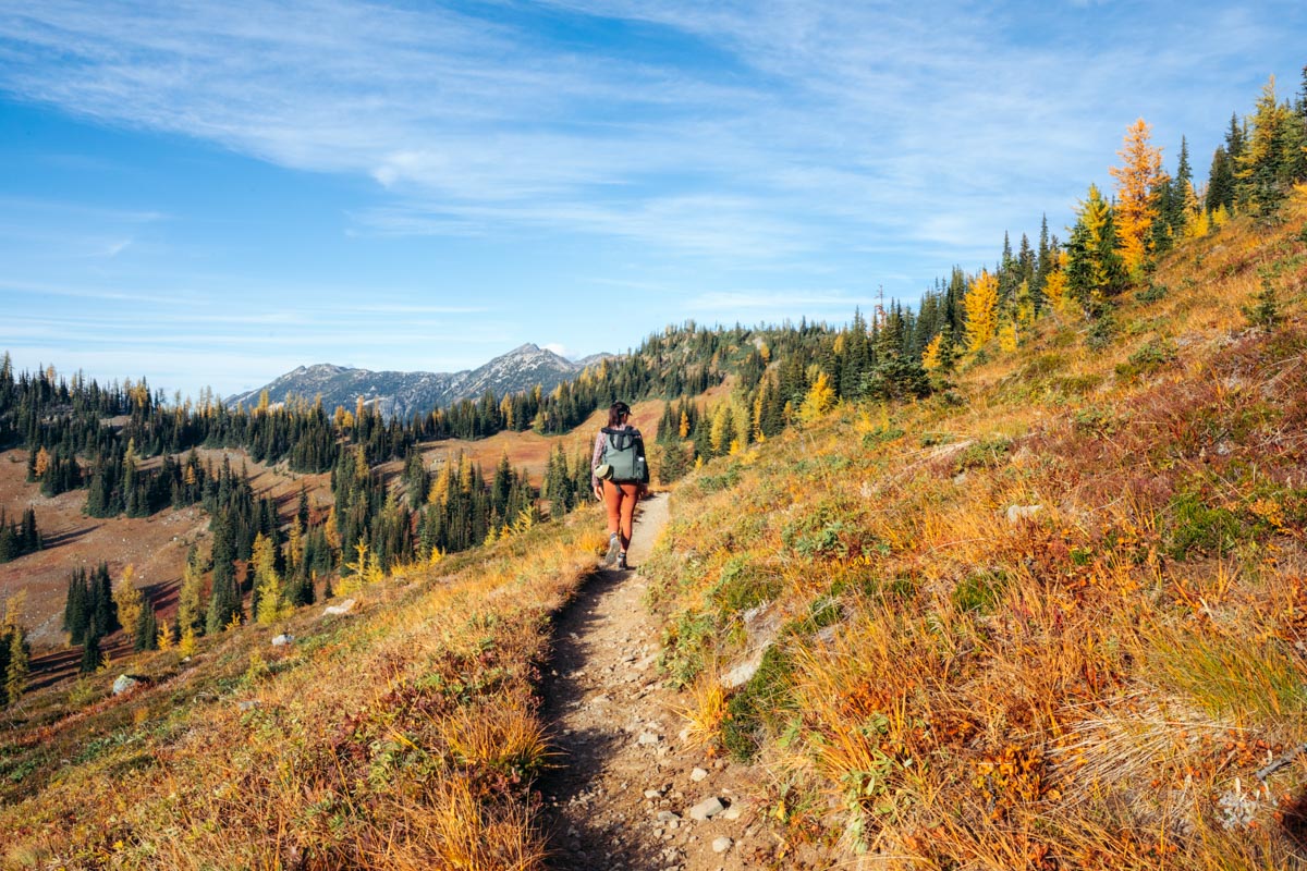
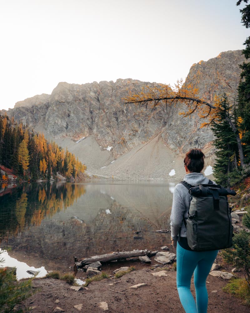
Day 1: Blue Lake Trail
Stats: 4.6 miles round-trip | 915 ft gain | 2–3 hours
Trailhead: Blue Lake Trailhead on Highway 20, 4 miles east of Rainy Pass
The Hike
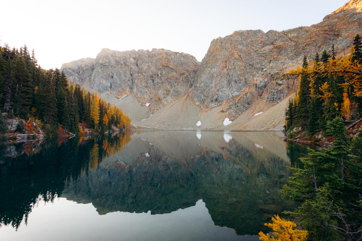
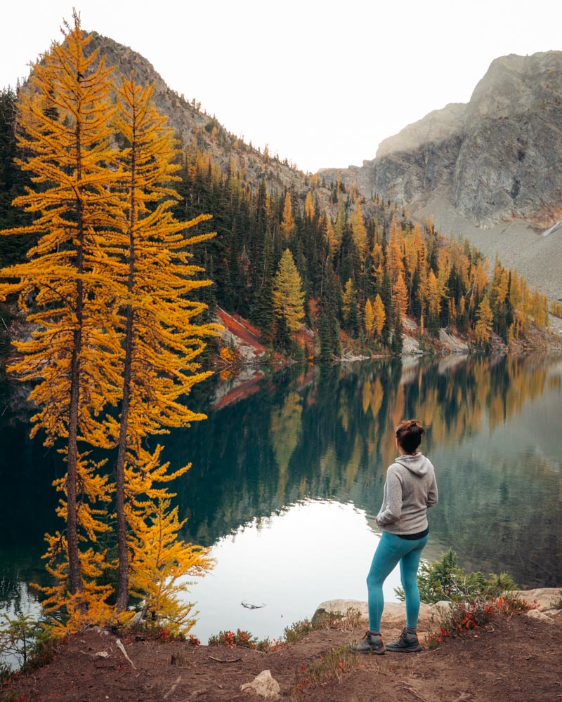
Blue Lake feels almost unfair for the effort it takes. The trail winds steadily through forest and meadows, and by about 1.5 miles, the larches start showing up. The grand finale is a turquoise alpine lake backed by Liberty Bell and the Early Winters Spires, with golden larches lining the shore. It’s a quick hike that still delivers the kind of views you’d expect from a much longer trek.
Fitness: If you regularly hike 4–5 miles with some elevation, this is very doable. Good intro to North Cascades alpine terrain.
Best photo spot: Walk to the far right side of the lake for perfect reflection shots in the morning calm. Sunrise light hits the peaks beautifully, but you’ll need to arrive in darkness (6am or earlier). Mid-morning works fine too.
Crowds: Arrive by 7:30am on weekends (the lot fills by 9am). Weekdays are kinder — around 9am usually works.
Facilities: Vault toilet at trailhead.
Afternoon Bonus: Drive 10 minutes east to Washington Pass Overlook (right on Highway 20) for sunset. It’s literally a 2-minute walk from the parking area to one of the best viewpoints in the state — Liberty Bell and Early Winters Spires glowing in alpenglow, golden larches in the foreground. No hiking required.
Family-friendly swap: Cutthroat Lake (4 miles, 400 ft gain). Shorter and easier, but still surrounded by larches and peaks.
If You Want More (Separate Trip):
Harts Pass and Slate Peak deserve their own day — they’re 90 minutes from Blue Lake and require serious commitment.
- Harts Pass → Grasshopper Pass: From the highest drivable road in Washington, hike north on the PCT toward Grasshopper Pass for wide-open larch meadows and ridge views (5–7 miles). This is remote, crowd-free larch heaven.
- Slate Peak for Sunset: At 7,440 ft, this is the highest point you can drive to in Washington State. A short walk from the end of the Harts Pass road gives you one of the most dramatic viewpoints in the Cascades.
- Road reality check: The 13-mile Harts Pass Road (FR 5400) from Mazama is a narrow, gravel road with steep drop-offs and exposed switchbacks. Plan on 45–60 minutes one way. Most sedans can make it in dry conditions, though high-clearance vehicles tend to feel more comfortable. If narrow mountain roads aren’t your favorite, this is worth considering when planning your trip. The road typically closes with the first significant snow, often by mid-October.
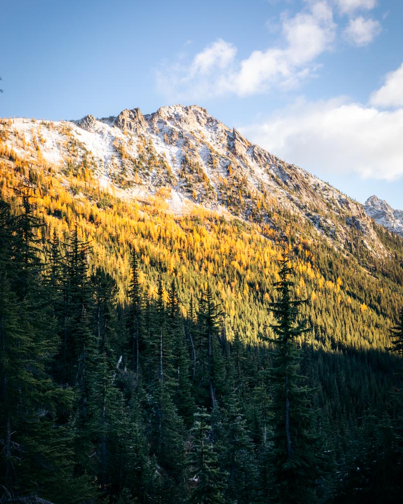
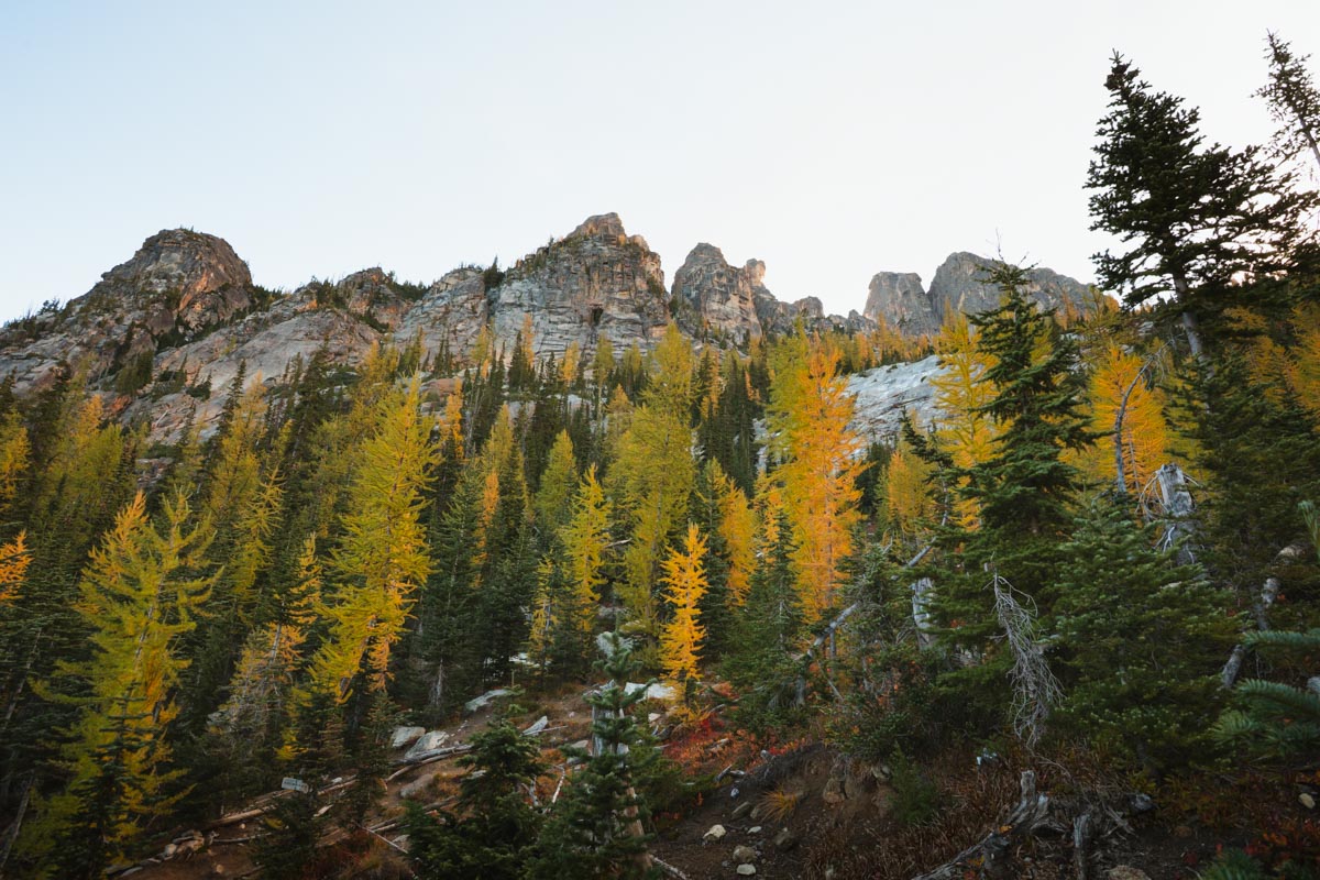
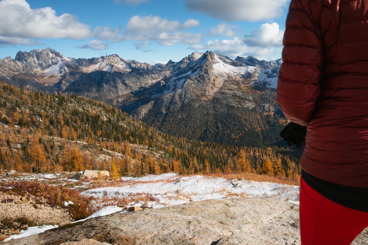
Day 2: Maple Pass Loop
Stats: 7.5 miles loop | 2,150 ft gain | 5–6 hours with photo stops
Trailhead: Rainy Pass Picnic Area on Highway 20
Why it’s the crown jewel
If you only do one larch hike in Washington, most say make it Maple Pass. For 7.5 miles you’re surrounded by insane views, larches, alpine lakes, and the hillsides are covered in red. It’s the classic for a reason.
Fitness check: Maple Pass feels different for everyone. The first 3 miles climb steadily, and the descent can be tough on knees. If you’re used to 8+ mile hikes with 2,000 ft of gain, it’ll feel moderate. If you’re newer to hiking, expect it to be more of a challenge — but totally doable with breaks, snacks, and a steady pace.
Crowd reality: On peak October weekends, the Rainy Pass lot fills by 6:00–6:15am. Options:
- Arrive painfully early (like 5:45am early).
- Hike midweek (way fewer people).
- Start from Rainy Lake trailhead instead (adds 2 miles but easier parking).
Facilities: Vault toilets at Rainy Pass.
The hike (clockwise recommended):
- Climb steadily through forest → golden meadows → Lake Ann.
- Continue to Maple Pass (6,600 ft) for jaw-dropping 360° views of Corteo Peak, Black Peak, and more.
- Descend through another round of larches before closing the loop.
Plan for 5–6 hours with plenty of photo stops. No reliable water sources after snowmelt ends, so carry enough.
Photography: Lake Ann is stunning in morning light (around 9–10am if you start at 6am). The pass itself is best late morning to early afternoon when the sun fully lights the meadows. Counterclockwise gives you better light on Lake Ann but a steeper descent.
Backup plan: If parking is impossible, swap today with Cutthroat Pass (Day 3) and come back tomorrow.
Evening: Treat yourself in Winthrop — wood-fired pizza and pasta at East 20 (our personal favorite), riverside beers at Old Schoolhouse Brewery, or sushi and burgers at Mazama Public House if you’re staying close.
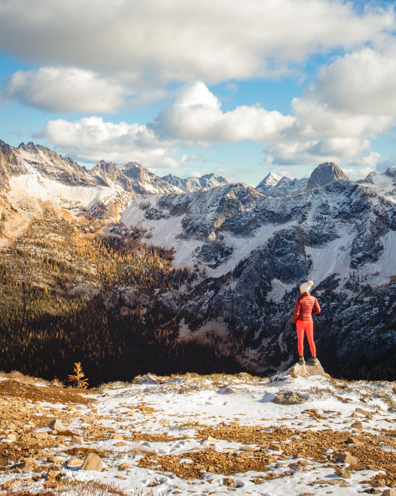
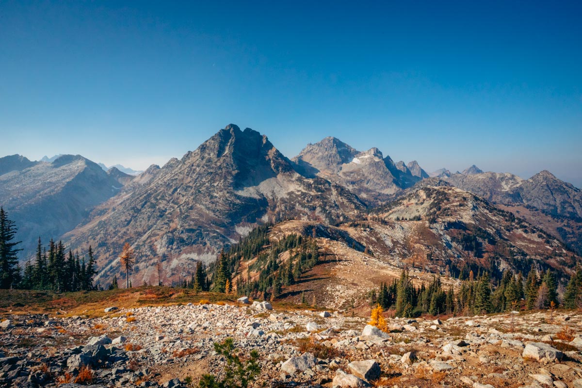
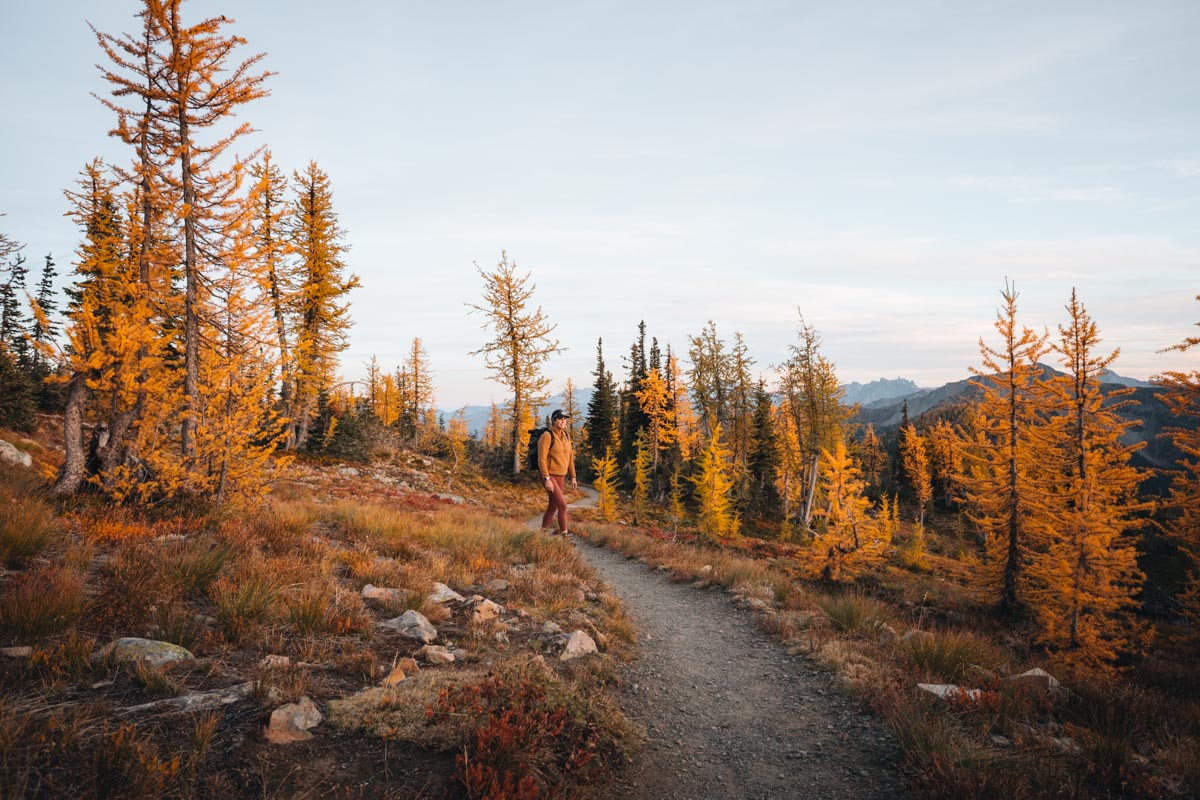
Day 3: Cutthroat Pass
Stats: 10 miles round-trip | 2,000 ft gain | 5–6 hours
Trailhead: Cutthroat Pass Trailhead on Highway 20, just east of Washington Pass or via the PCT (right across the street from Maple Pass) Link to AllTrails
The Hike
Cutthroat Pass is a dream: miles of larch-dense forest that open into alpine meadows with sweeping views of Cutthroat Peak, Liberty Bell, and Early Winters Spires. It’s a steady climb but never brutal, and the payoff at the pass (6,800 ft) is unforgettable.
Fitness: Longer than Blue Lake, easier grade than Maple Pass. If you’re comfortable with 10-mile days, this is straightforward.
Crowds: Arrive by 7:30am on weekends, 8:30am on weekdays.
Facilities: Vault toilet at trailhead.
Water: No reliable sources after snowmelt; carry enough for the full hike.
Day 3 Alternatives:
- Easy Pass (7 mi, 1,800 ft gain): Steeper and shorter with big payoff. Less crowded than Maple Pass but equally stunning views.
- Cutthroat Lake (4 mi, 400 ft): Easier option, kid-friendly, and still gorgeous. Same trailhead as Cutthroat Pass.
- Diablo Lake area: If weather turns bad, the turquoise water + moody skies still make for incredible photos. No larches, but worth the backup plan.
- Explore Winthrop: After two big hiking days, coffee and pastries at Mazama Bakery or The Little Dipper might be the real win.
🏕️ Where to Stay
Mazama (closest to trailheads): Mazama Country Inn (hotel-style rooms with restaurant, $200–300/night), Lost River Resort (cabins, $250–400/night), or vacation rentals. Book 3–6 months ahead for peak larch weekends — lodging sells out fast.
Winthrop (30 minutes farther): More food and lodging variety ($150–250/night range), lively Old West downtown vibe. Easier to find last-minute availability.
Camping: Lone Fir, Early Winters, or Klipchuck campgrounds ($20–30/night). Reserve through Recreation.gov as early as possible — these fill up too.
If the east side is fully booked: Concrete or Rockport on the west side work, but you’re adding 90+ minutes each way to the trailheads (so 5am starts become 3:30am starts). Chelan is about the same distance as Winthrop but requires backtracking — only worth it if you’re combining this with other Chelan-area plans.
Budget estimate: Expect $80–120 in gas round-trip from Seattle, $30 for the NW Forest Pass if you don’t have one, plus lodging and food.
What to Pack
- Layers: Base layer (synthetic/merino), insulating fleece/puffy, rain jacket, warm hat + gloves.
- Trail gear: Trekking poles, microspikes (after Oct 5), headlamp, first aid kit, extra snacks/water. Note: no reliable water sources on Maple Pass or Cutthroat Pass after snowmelt ends.
- Photography: Wide-angle lens (16–35mm range) for sweeping meadows, polarizing filter for lake reflections, extra batteries (cold drains them fast).
Arrival Cheat Sheet
- Maple Pass: 6:00am weekends, 7:30am weekdays.
- Blue Lake: 7:30am weekends, 9:00am weekdays.
- Cutthroat Pass: 7:30am weekends, 8:30am weekdays.
Midweek = dramatically less stress.
Backup larch areas if Highway 20 is closed or weather is terrible: The Teanaway area near Cle Elum has larches at Ingalls Lake and Esmeralda Basin (both harder hikes). Not as dramatic as the North Cascades, but closer to Seattle and can be stunning. Check those if you need Plan B.
✨ Final Thoughts
Larch season in the North Cascades takes effort — the early alarms, the packed trailheads, the scramble to book lodging months in advance. But once you’re standing in a golden meadow with jagged peaks all around, you’ll understand why hikers plan their entire fall around this tiny two-week window.
Show up early, pack smart, and stay flexible with backups. Check current conditions the week before you go — a warm September can push peak later, while an early cold snap can speed things up. Whether you stick to the core hikes or add extras like Harts Pass and Slate Peak (on a separate day), this itinerary gives you the best shot at catching peak color without burning out.
A few last tips: Download offline maps since cell service is nonexistent. Tell someone your hiking plans. Bring more warm layers than you think you need — October weather in the alpine is wildly unpredictable. And if parking is full when you arrive, have a backup hike ready rather than parking illegally on the highway shoulder (you will get ticketed).
When to bail: If the forecast shows sustained rain/snow, zero visibility, or temperatures below 20°F (-7°C) at the pass, consider rescheduling. Ice on exposed trail sections without proper traction gear is genuinely dangerous. The larches will still be there next year.
See you out there among the larches. 🌲💛
🍁 More Fall Adventures in Washington
If chasing golden larches has you hooked, here are a few more trails and guides you’ll love:
- Golden Larches in Washington — a roundup of the best spots across the state to see them glow.
- Golden Lakes Loop Backpacking Guide — a longer fall adventure with lakes, larches, and fewer crowds.
- Best Fall Hikes in Washington — more trails with fiery colors, waterfalls, and crisp mountain air.


