
Best Golden Larch Hikes in Washington: When & Where to See Fall Colors (2026)
I’ll never forget my first peak larch season. It was just after sunrise at the far end of Colchuck Lake.
I’d seen fall color before. But nothing quite like this.
That was six years ago. Since then, I’ve planned most of my October weekends around larches.
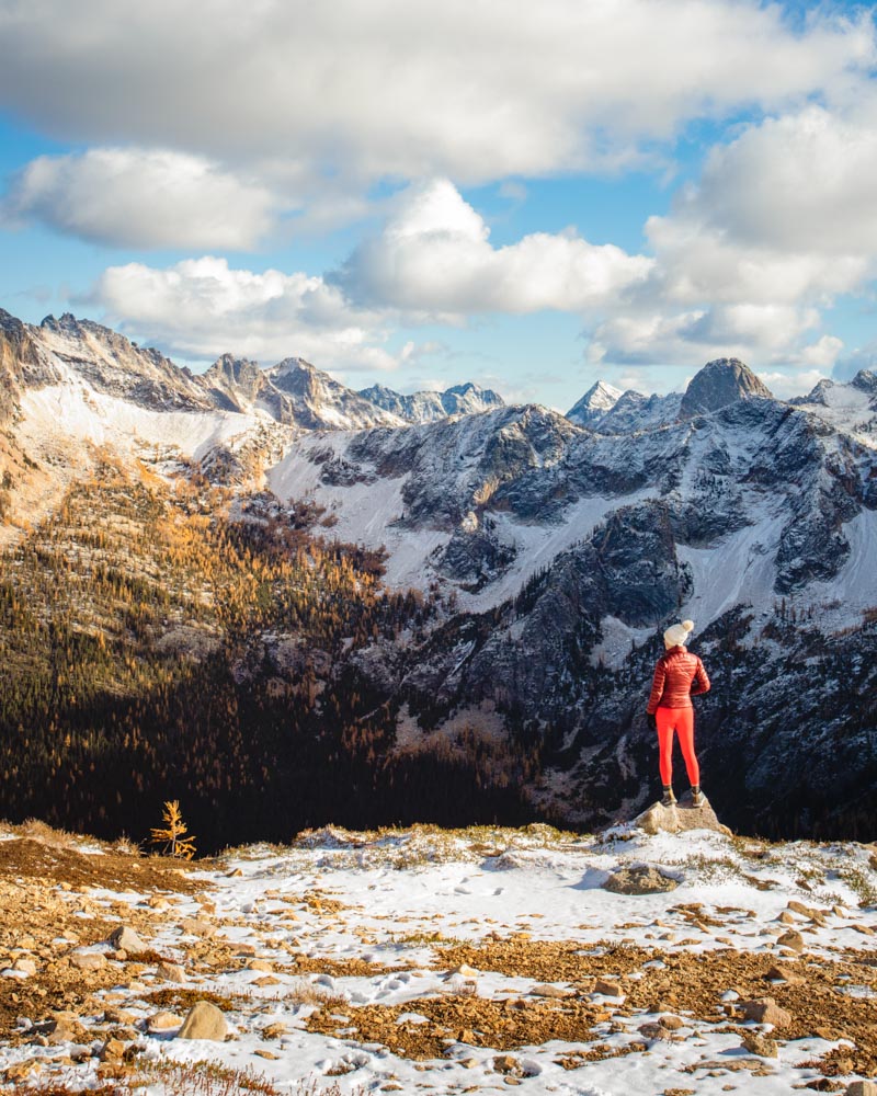
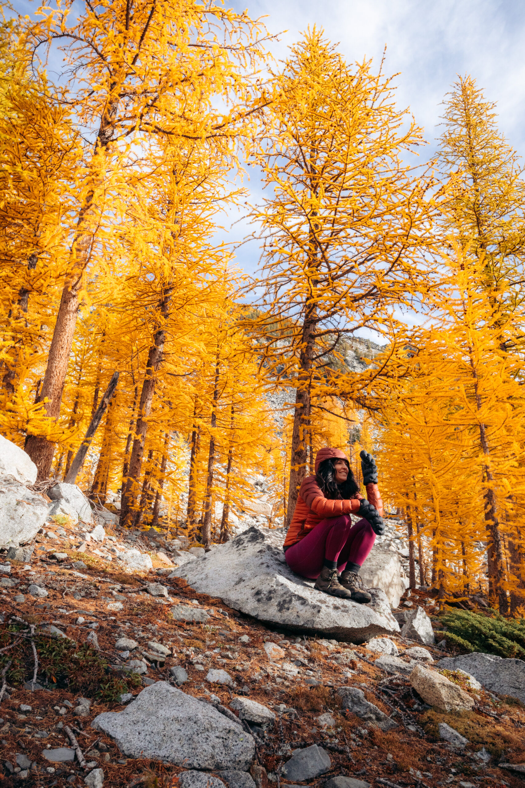
October in the alpine means freezing mornings, exposed ridgelines, and weather that changes fast. Even on calm forecasts, conditions at 6,000–7,000 feet can shift quickly. I never head out without warm gloves and a merino beanie this time of year.
Altogether, this guide covers Washington’s most reliable larch hikes, with elevation-based timing windows, practical crowd strategies, and ways to track peak conditions each season.

Quick Larch Season Reference
Peak Window: Late September – mid October (varies by elevation)
Golden Period: 10–14 days at each elevation band
Elevation Range: 3,500–7,500 feet
Best Historical Week: October 1–7
Weather Watch: Before first major snowstorm
Parking Reality: Popular trailheads fill by 6:00–6:30 a.m. on peak weekends
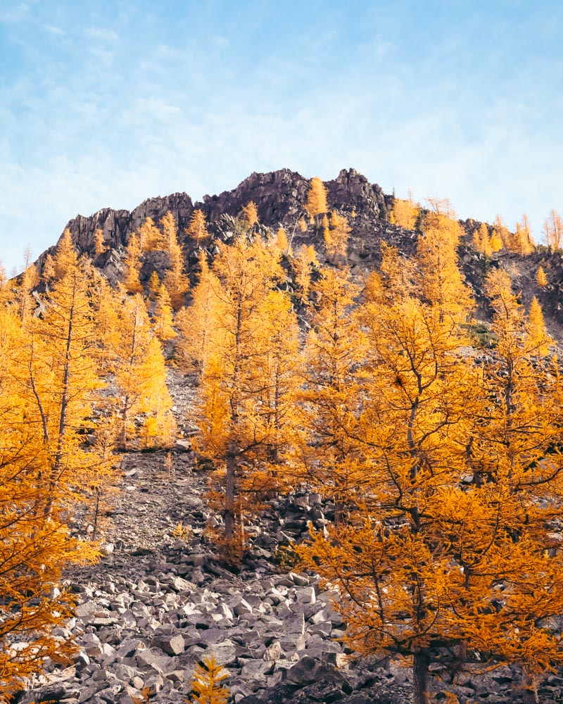
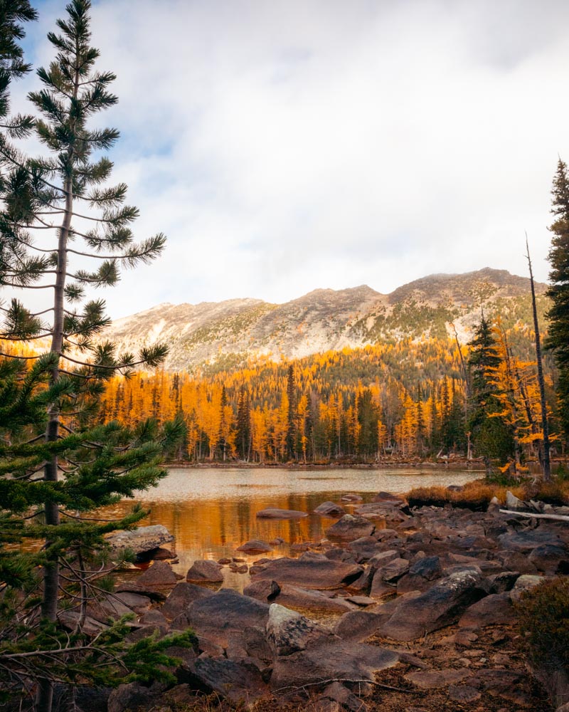
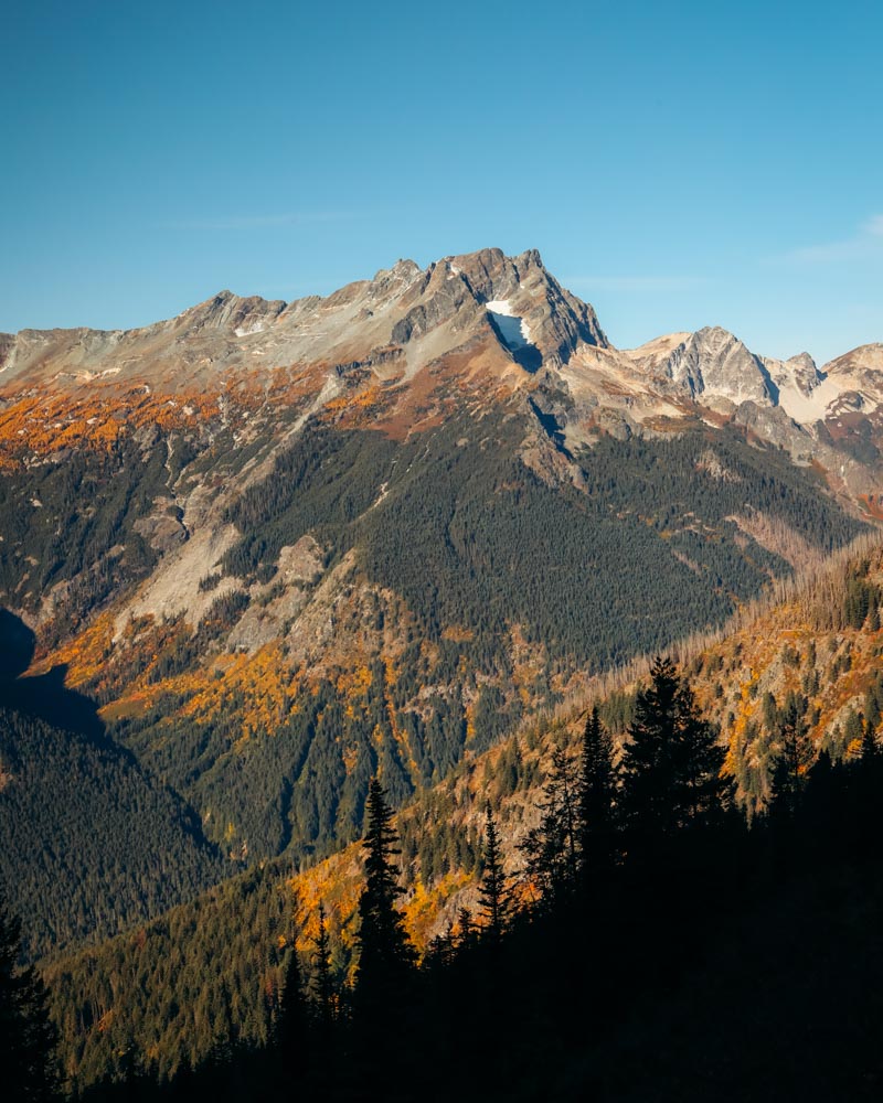
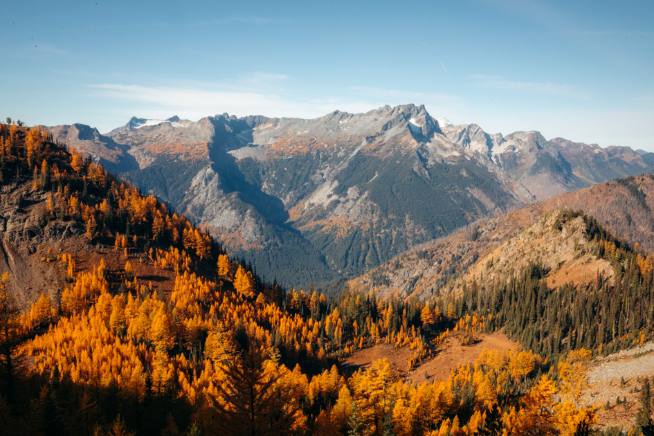
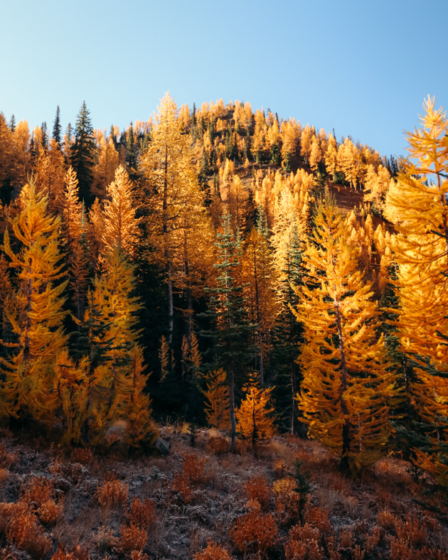
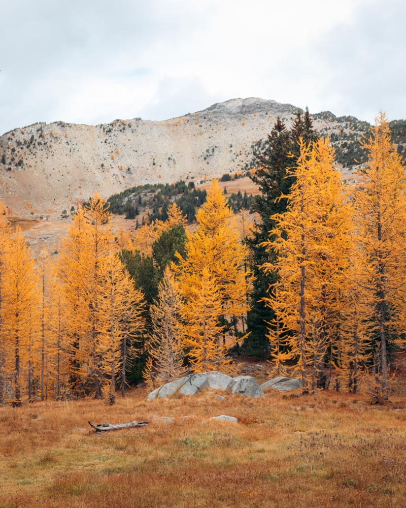
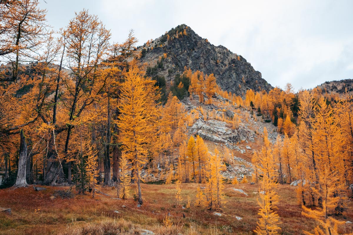
Why Washington’s Larches Are Special
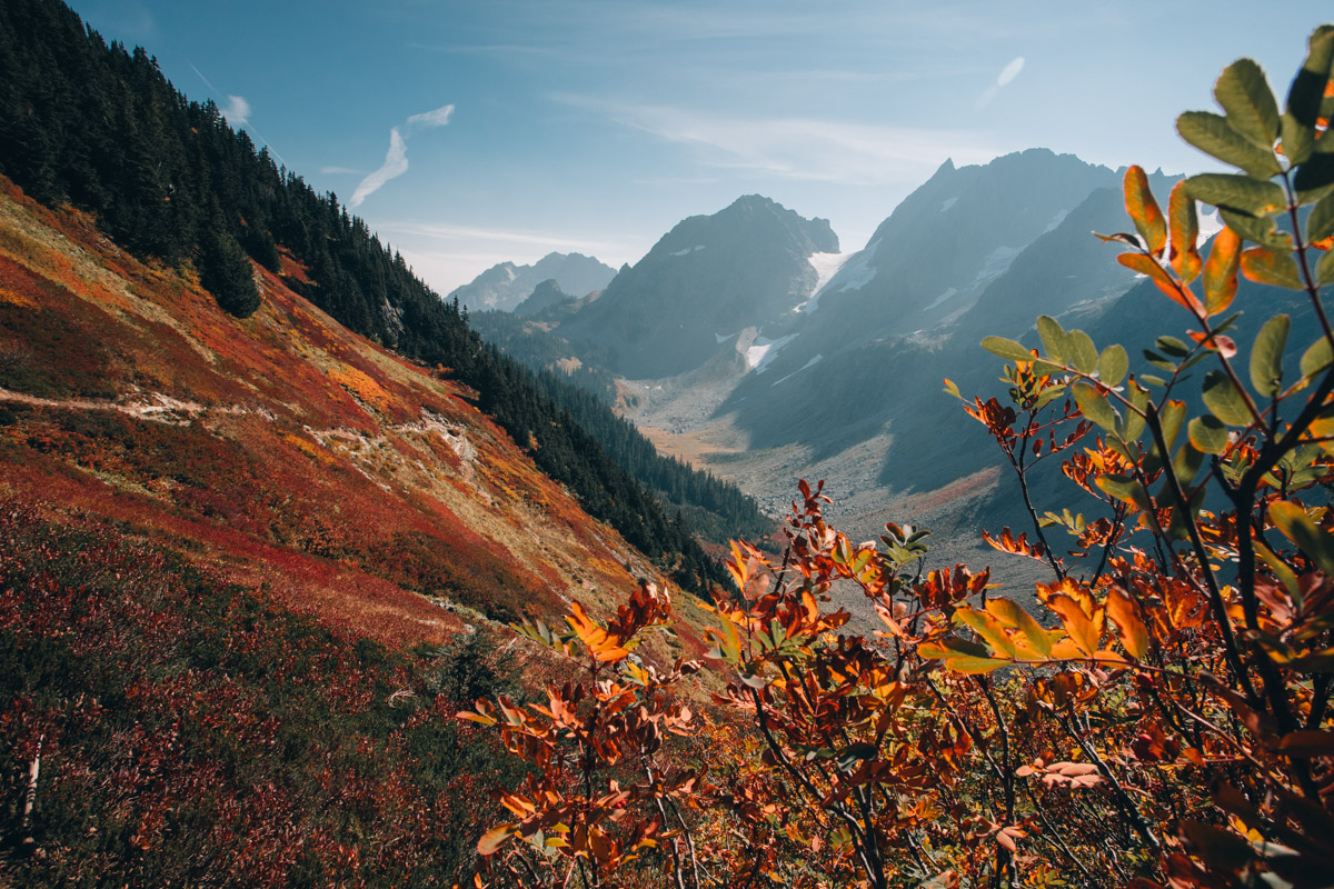
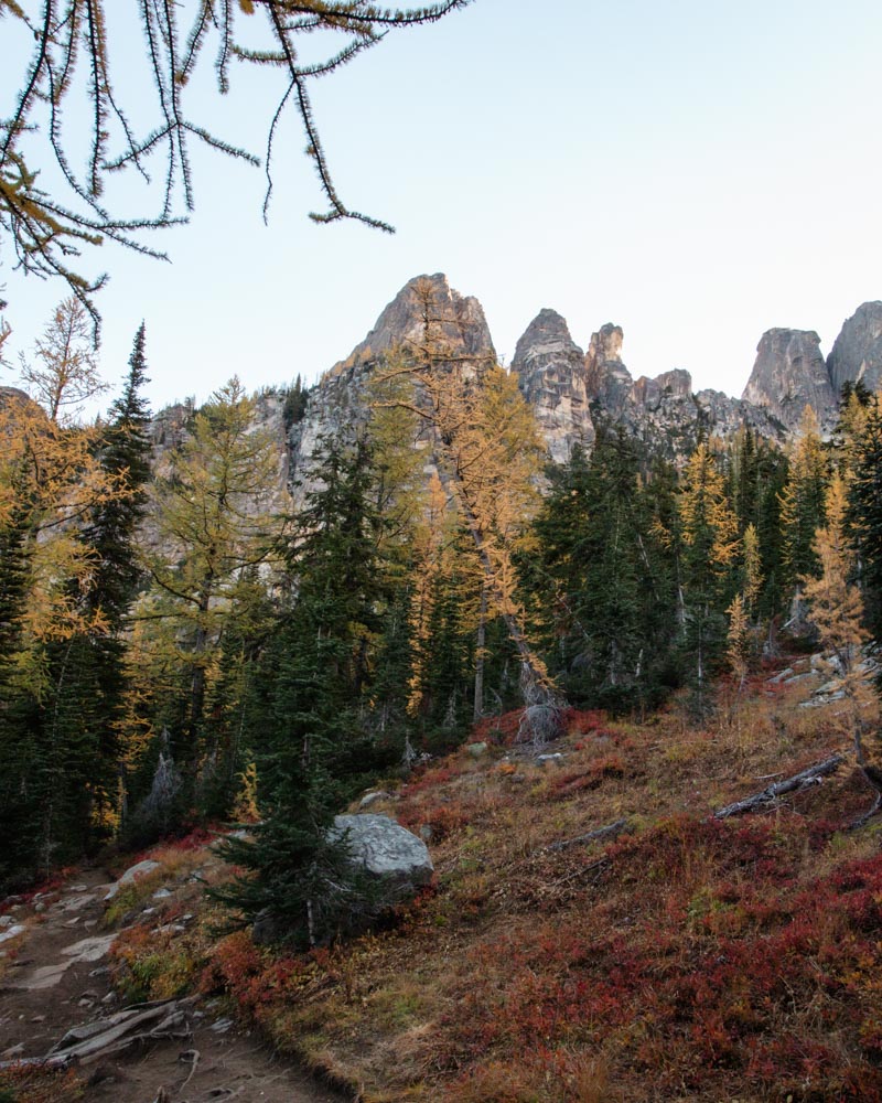
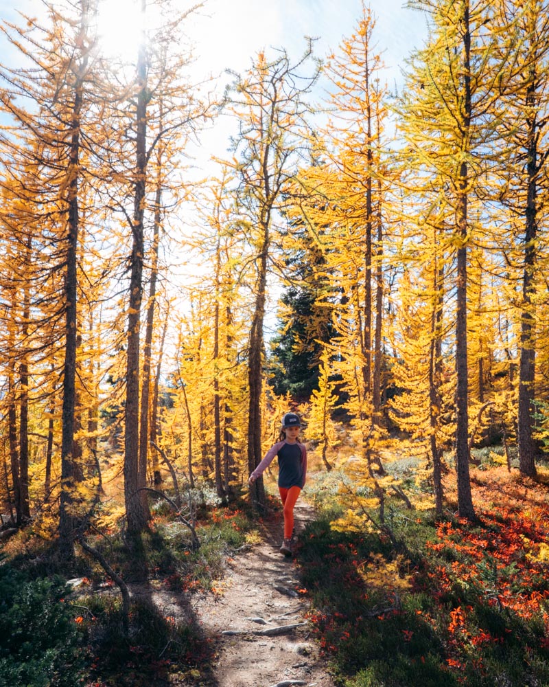
Larches look like evergreens most of the year. You’d walk right past them in July and never think twice. And then in early October, they turn completely gold and drop their needles a few weeks later.
It doesn’t last long.
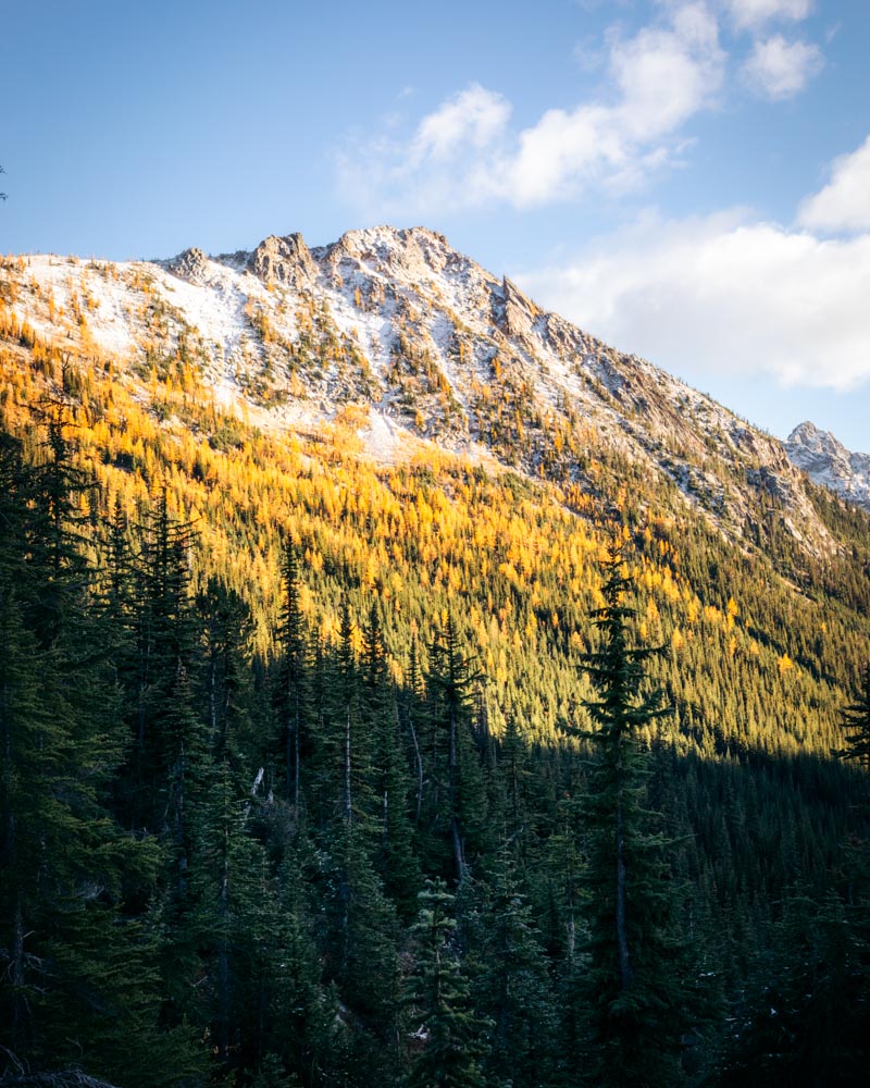
Most grow between about 4,000 and 7,500 feet, which is why elevation matters more than the calendar. A hike at 5,000 feet might be glowing while something 1,000 feet lower is still fully green.
We mainly see two types here:
- Western larch — more common at mid-elevations
- Subalpine larch — higher, usually in more rugged terrain
The shift happens quickly. Ten days. Maybe two weeks. And sometimes an early storm cuts it short.
How to Think About Crowds During Larch Season
Larch season has gotten busier over the past few years — especially on the most photogenic trails.
On peak October weekends, popular trailheads like Maple Pass or Blue Lake can fill before 6:30 a.m. That doesn’t mean every hike is packed. It means the most accessible, highest-reward trails draw the earliest arrivals.
Elevation and road access make a big difference.
Higher, longer approaches tend to thin out naturally. Midweek feels completely different than a Saturday. And sometimes shifting your hike 1,000 feet higher or lower can change the experience entirely.
If you’re planning a specific trail, have a backup nearby. Not because the day will be ruined — but because flexibility is part of hiking in October here.
First time heading into the alpine for larches? Here’s exactly what I pack for a one-night backpacking trip and my full guide to planning your first backpacking trip.
Best Classic Golden Larch Hikes in Washington
These are the hikes most people picture when they think of golden larches in Washington. They’re accessible, scenic, and consistently deliver during peak season. They’re also popular — especially on October weekends — but there’s a reason they’ve become classics.
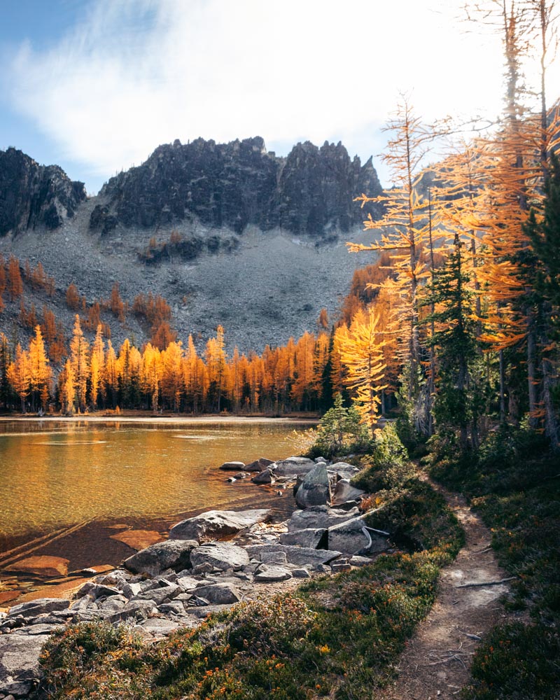
Cutthroat Pass
8–10 miles round trip (depending on approach) | ~2,000 ft gain
Why it works: Reliable larch concentration with wide-open alpine views
Crowd reality: Moderate midweek, busy on peak October weekends
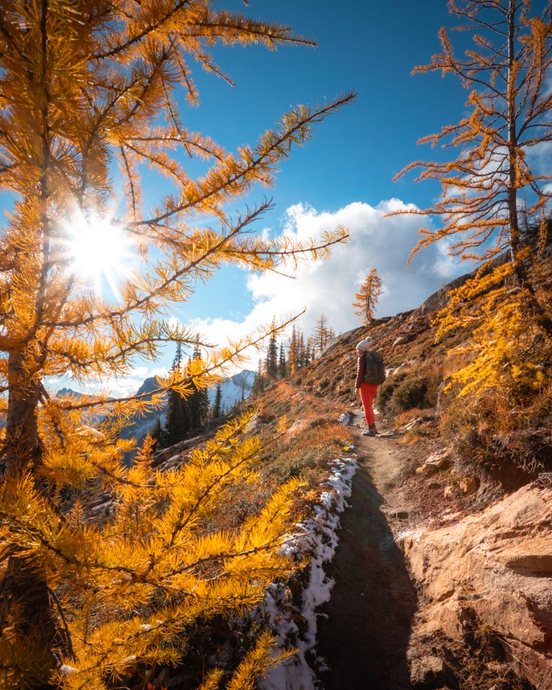
This is usually my first recommendation for someone chasing larches for the first time. The grade is steady, the payoff is consistent, and the views open up quickly once you reach the pass. While Maple Pass gets more attention, Cutthroat often feels a little more manageable and just as rewarding.
There are two approaches. From Rainy Pass, you can follow the PCT north for a gentler grade. From Cutthroat Lake, the climb is steeper but scenic. The lake at mile 2.5 makes a natural turnaround for families. Beyond that, the trail climbs steadily through thicker stands of larches before reaching the pass at mile 4.9.
Morning light tends to hit the larches above the lake first. At the pass, later afternoon light adds more dimension to the ridgelines. I usually bring a tripod if I’m planning to linger.
The pass is exposed and can feel noticeably colder than the trailhead. I’ve seen early snow here before October. A merino base layer makes a difference if you’re spending time at the top, and after early October I bring microspikes for shaded sections near the pass.
Quick logistics:
Two access points on Highway 20. Parking fills early on fall weekends — before 7 a.m. is safest in peak season.
Combine with nearby Blue Lake, just 10 minutes down Highway 20, to catch a different elevation band in the same day.
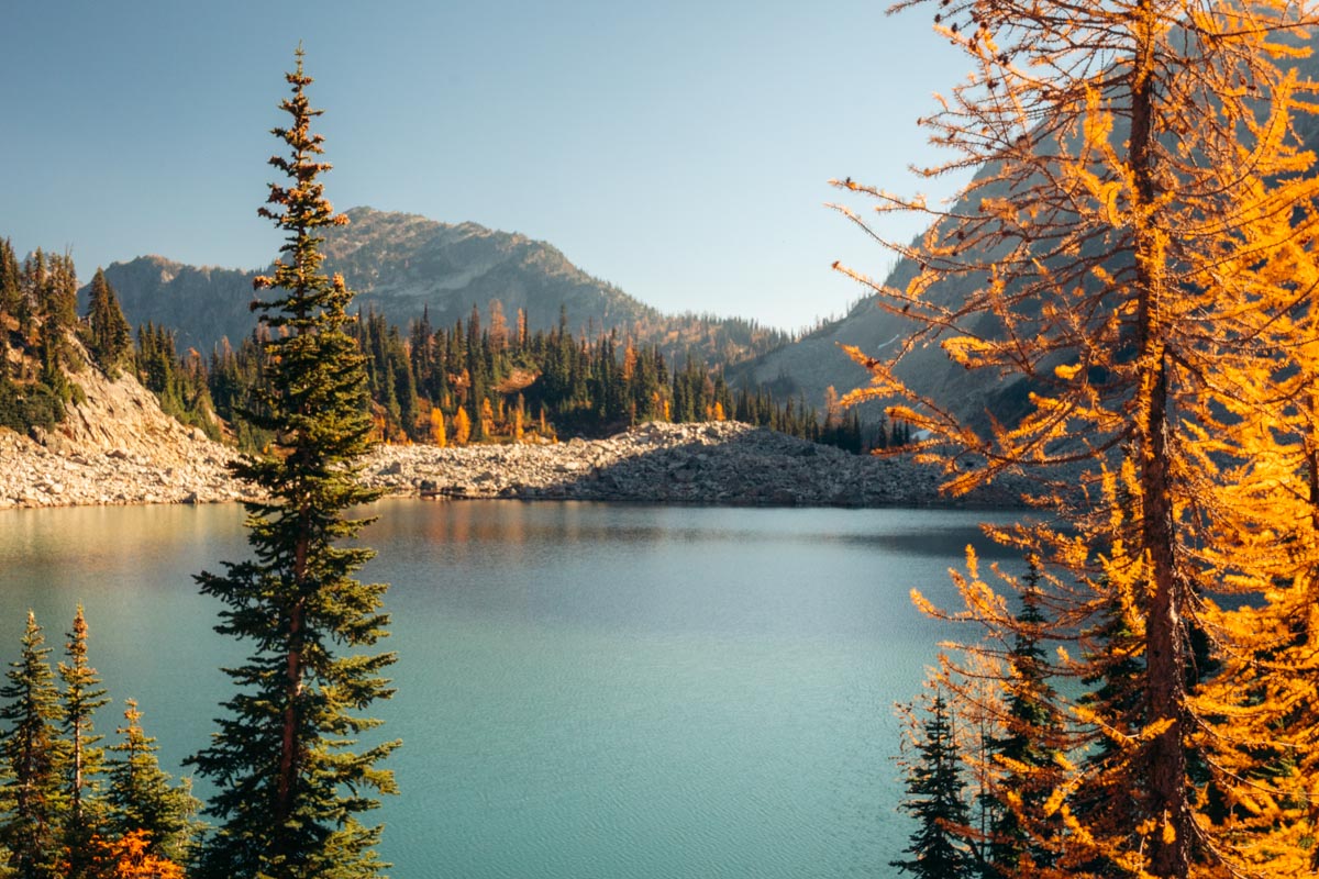
Blue Lake
4.4 miles round trip | ~600 ft gain
Why it works: Big scenery without a huge time commitment
Crowd reality: Extremely popular — go early in October
This is the hike I send people to when they want larches without committing to a long day. It’s short, but it still feels alpine. I’ve written a full Blue Lake Trail Guide if you want detailed timing and parking strategy.
You get views across Highway 20 early on, with Liberty Bell rising above the trees. Larches start appearing before you reach the lake, and then the final stretch opens into a wide basin of granite walls, clear water, and trees tucked into the slopes above the shoreline.
Walk toward the north end of the lake and spend some time along the water. Morning light gradually moves across the rock wall behind the lake and into the trees. It feels layered and quieter than the straight-on view most people stop for.
If you have extra energy, follow the informal paths that climb slightly above the basin. Even a short rise gives you more depth — lake below, Liberty Bell across the way, and larches wrapping the hillsides.
For sunrise light or reflections, this is one of the few shorter hikes where bringing a tripod feels worthwhile. If you’re moving around the shoreline rocks or heading up behind the lake, a camera clip keeps your camera accessible without digging through your pack.
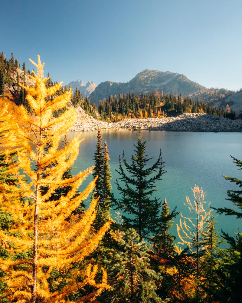
Maple Pass Loop
7.2 miles loop | ~2,000 ft gain
Why it stands out: A ridgeline walk that feels almost unfairly beautiful
Crowd reality: Very busy during peak larch weekends — go early or midweek
I avoided Maple Pass for years. Every October my feed filled with the same Lake Ann photo, and I assumed it was overhyped.
Then I finally hiked it in peak larch season.
What makes this hike stand out is the ratio of effort to payoff. It’s not overly long. It’s not relentlessly steep. And while the larches are beautiful, it’s really the scale of the views that carry the experience. You don’t need to be a hardcore hiker to feel fully immersed up there — and that accessibility is part of what makes it special.
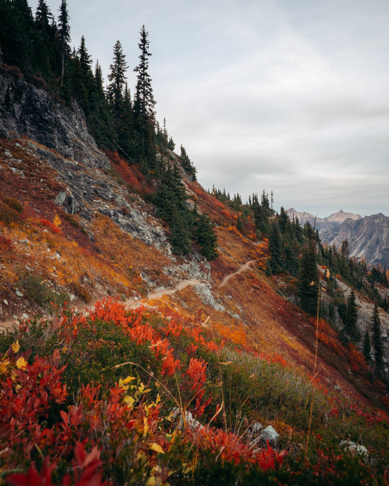
The climb builds steadily before breaking above treeline. If you go counterclockwise, you reach the ridge sooner, which I prefer. From there, the trail opens into wide views across Lake Ann and multiple basins wrapped in gold.
The ridge is exposed, even on calm days. II keep a packable rain jacket handy because the wind can pick up quickly. On the descent, trekking poles help once your legs are feeling the miles.
If you want detailed timing, parking strategy, and how I decide when it’s actually “worth the hype,” I break it down fully in my Maple Pass Loop Trail Guide.
Yes, it’s busy in October. But start early or go midweek, and it feels different.
Quick logistics:
NW Forest Pass required | No dogs | Parking fills very early in peak October
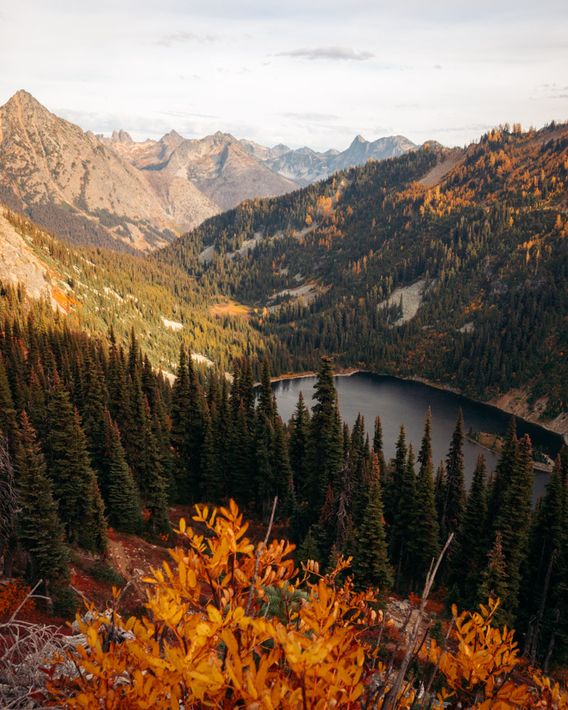
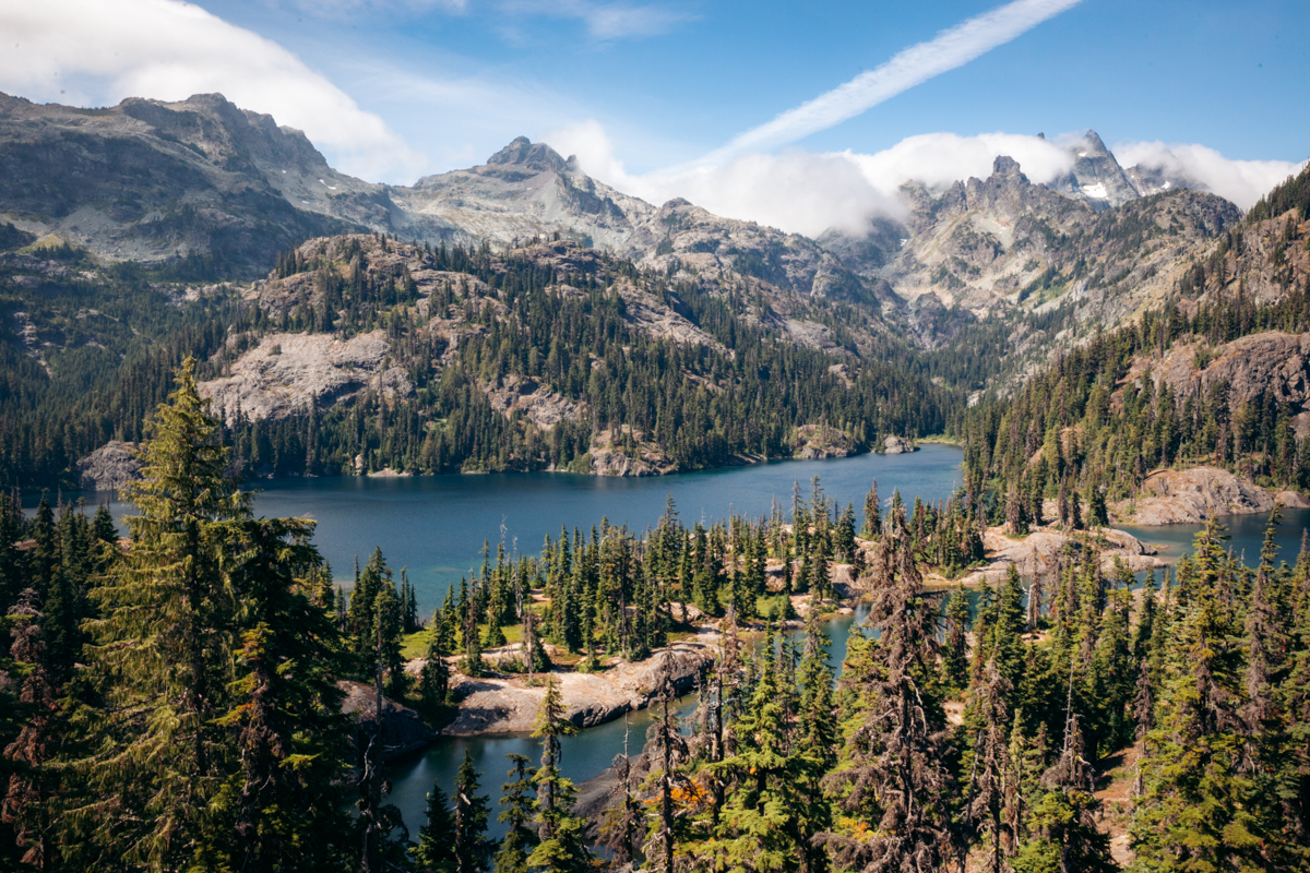
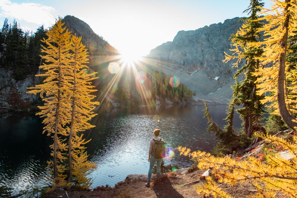
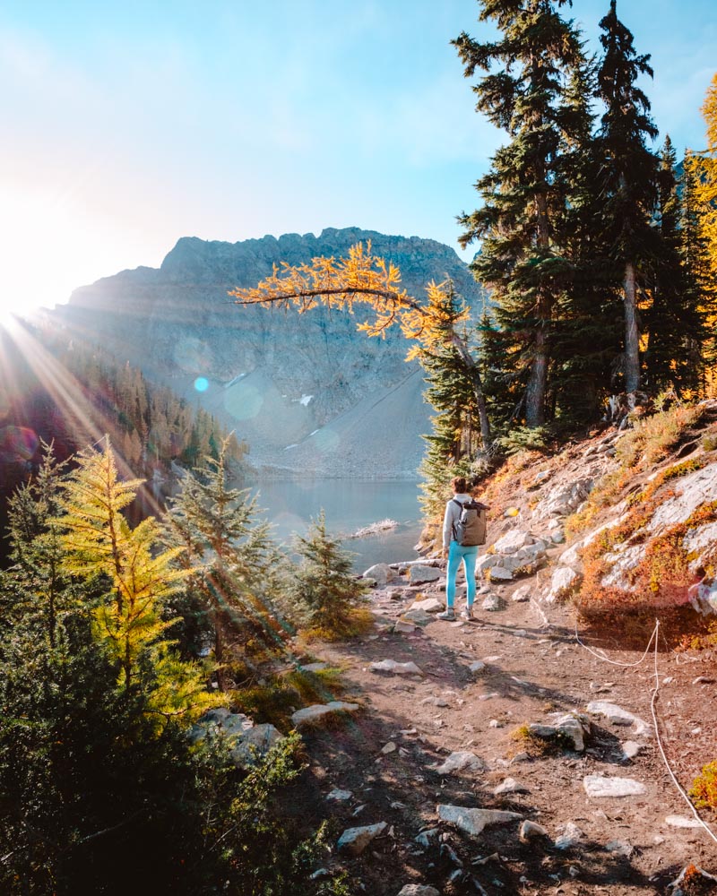
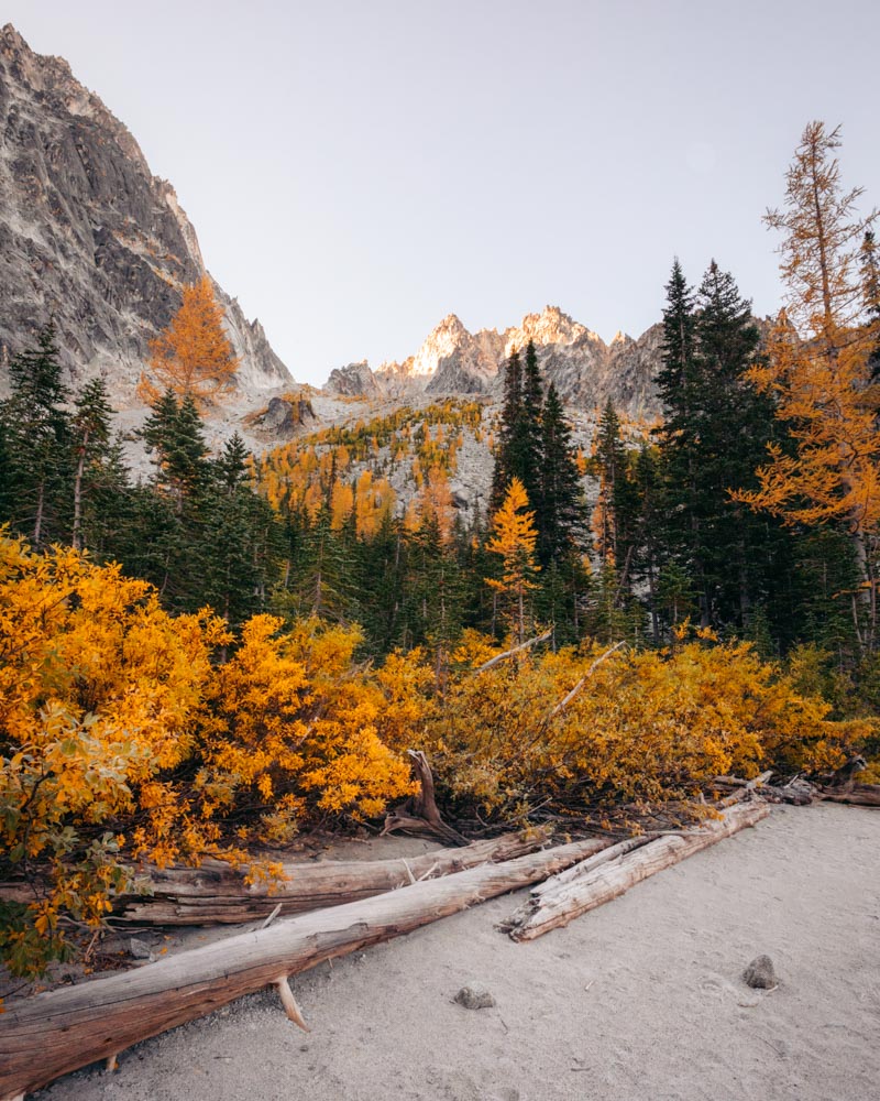
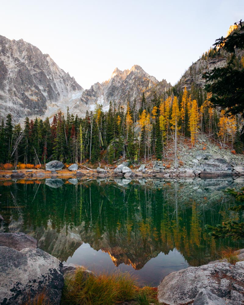
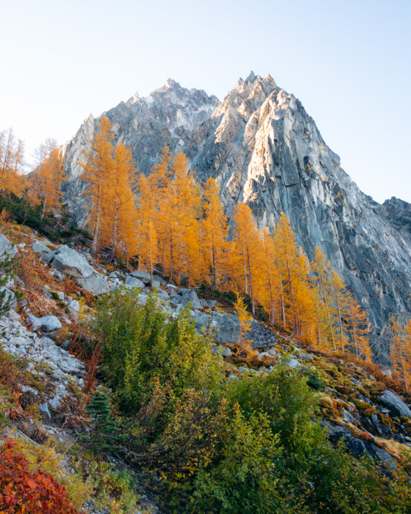
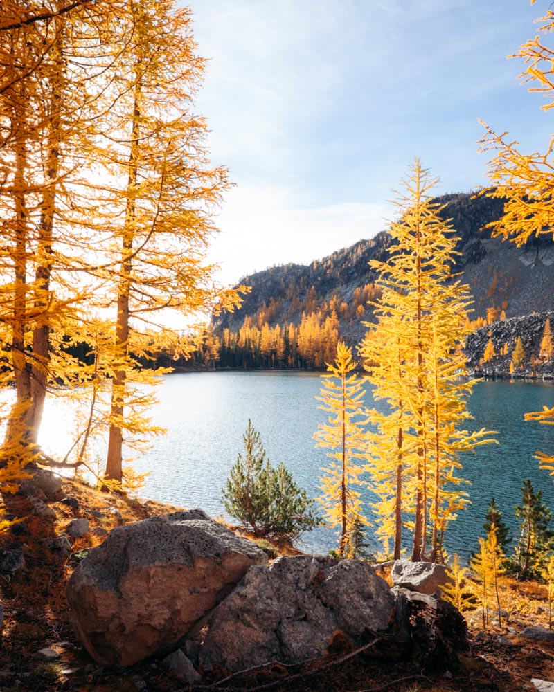
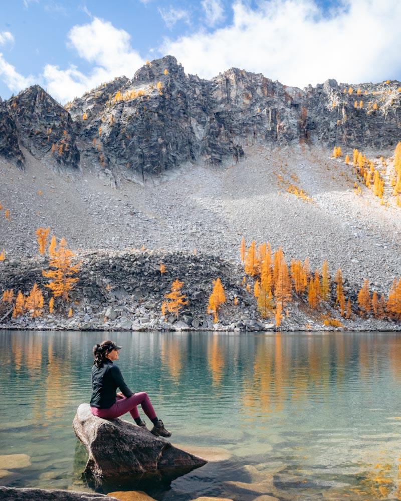
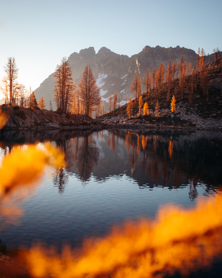
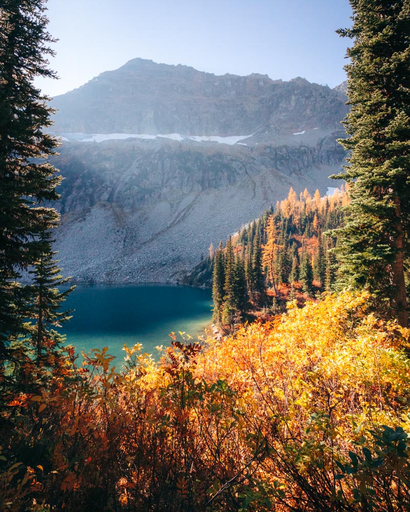
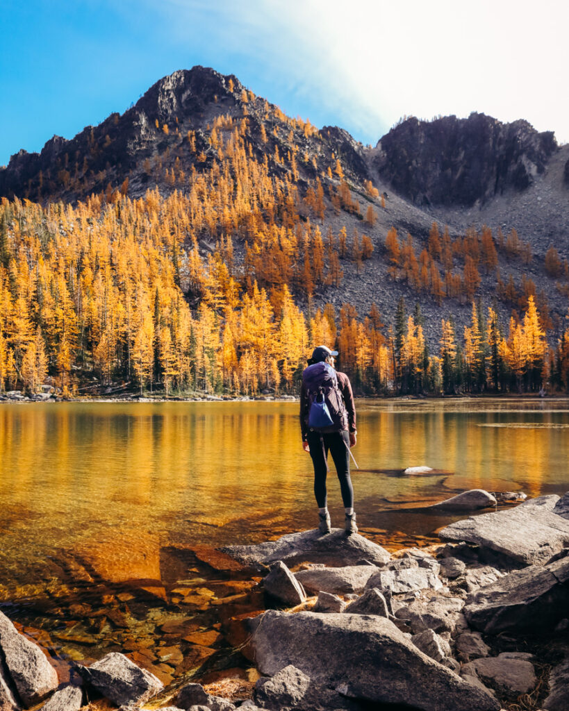
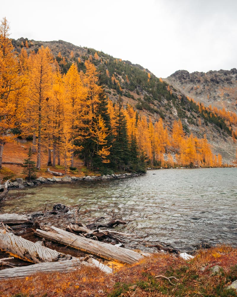
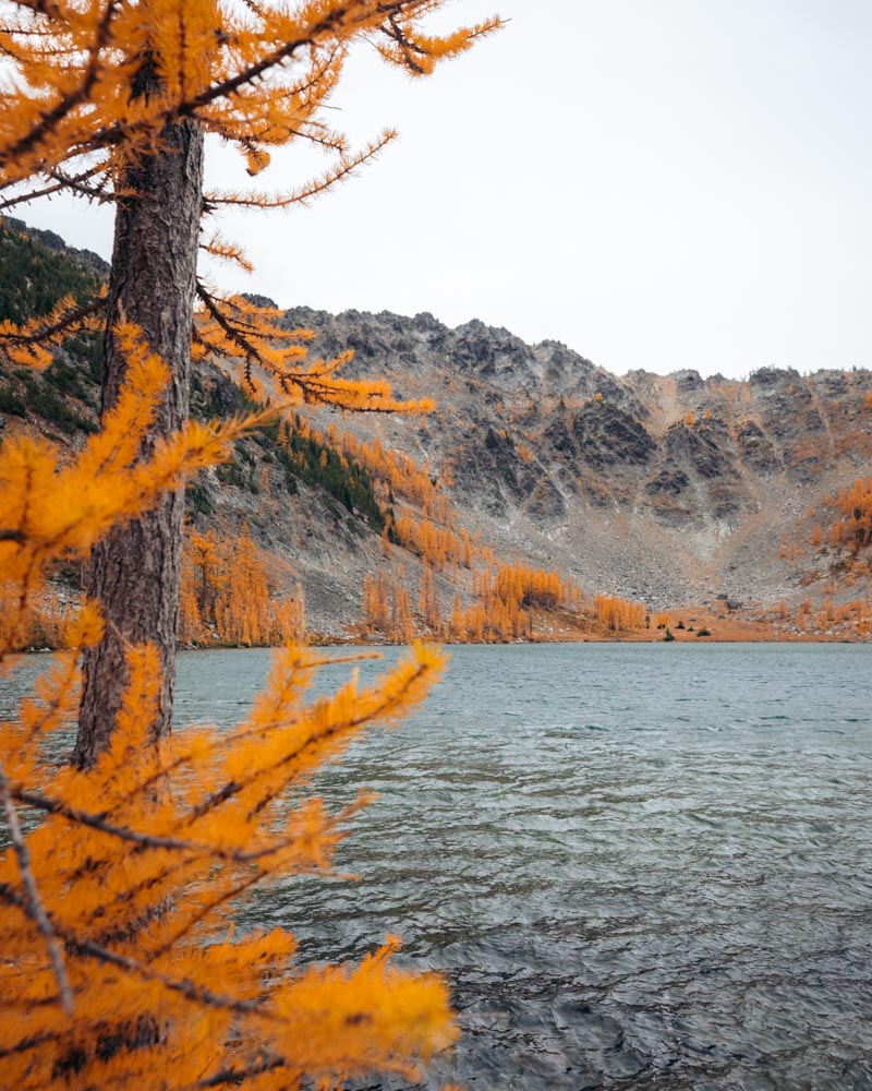
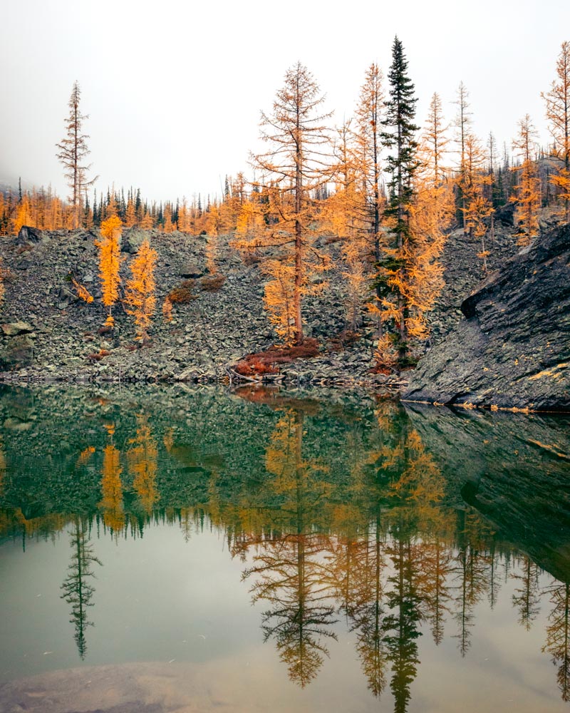
Colchuck Lake
8 miles round trip | ~2,300 ft gain
Why it works: Iconic alpine lake with larches clustered near the base of Asgard Pass
Crowd reality: Very crowded in peak October — plan for an early start
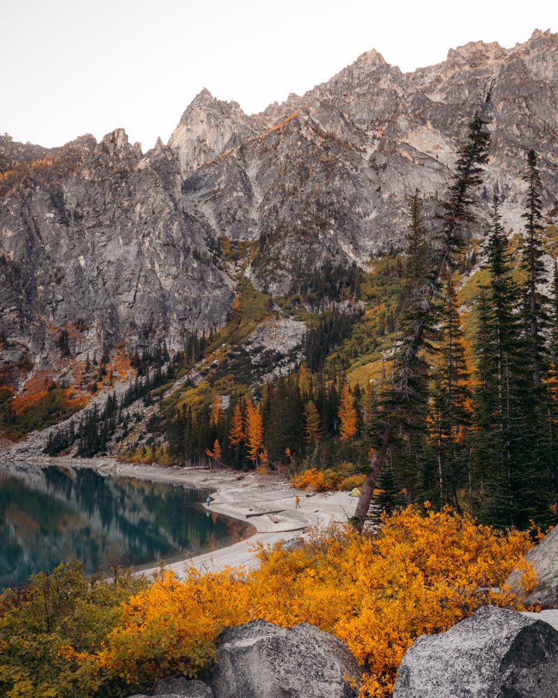
Colchuck is probably the most photographed lake in Washington — and for good reason. It’s not necessarily the most concentrated larch experience in the state, but when the trees at the far end of the lake turn gold beneath Dragontail Peak, it’s hard to argue with the setting.
The trail starts gently, then climbs steadily through forest before turning steeper and rockier after mile two. It’s a sustained climb, but it’s straightforward and well-traveled.
Most of the larches grow near the base of Asgard Pass at the far end of the lake. Walk the shoreline trail past the first lake views to reach the densest concentration. That final stretch is where the color feels most layered against the granite walls.
Yes, it’s busy in October. Parking fills very early — often before 5:30 a.m. on peak weekends — and overflow adds mileage. Midweek helps. So does going slightly later in the season, when crowds thin but the lower-elevation trees around the lake are still holding color.
Mountain goats are common near the far shoreline. Keep your distance and give them space.
Quick logistics:
Northwest Forest Pass required | No dogs | Overflow parking adds ~2 miles round trip
Bonus note:
If you’re primarily chasing dense larch stands, the upper Enchantments have a higher concentration — but that’s a much bigger day.
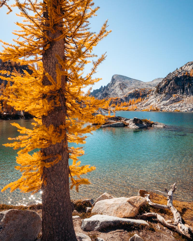
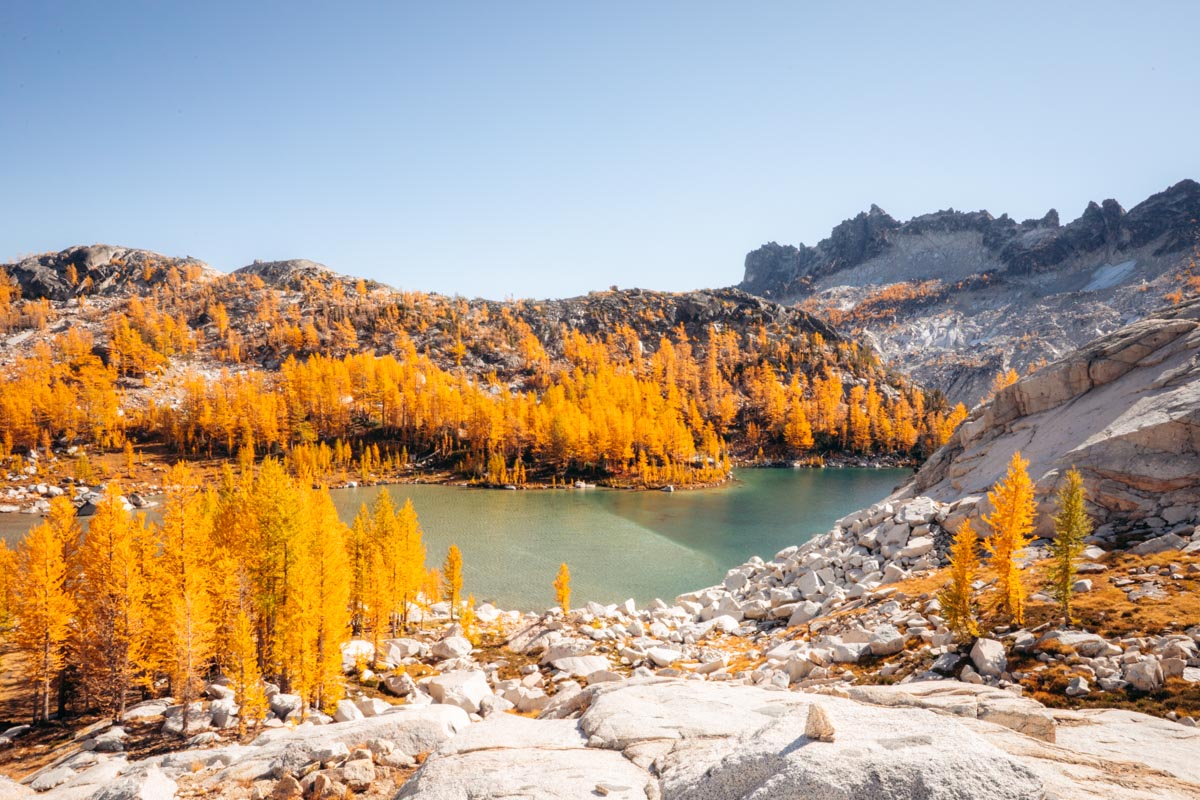
Core Enchantments (Thru-Hike)
18 miles one way | ~4,500 ft gain
Why it’s special: Granite basins, alpine lakes, and larches scattered through high country
Crowd reality: Overnight permits are lottery-based. Day thru-hikes are possible but long.
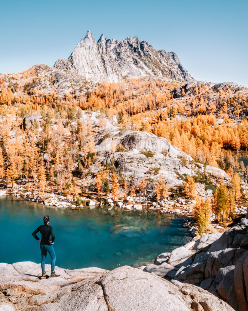
If you’re comfortable with distance and want classic Washington alpine scenery with larches threaded into it, the Core Enchantments thru-hike is the full experience.
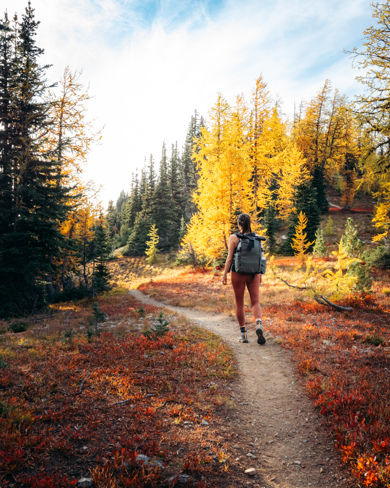
The terrain is unmistakably North Cascades — granite basins, clear lakes, long ridgelines — and in late September through the first half of October, larches glow across the upper basin. It’s a long day, but the climbing is steady. Start early, pace yourself, and it’s manageable if you’ve trained for the mileage.
I walk through permits, pacing strategy, shuttle logistics, campsites, and route options in detail in my Complete Guide to Thru-Hiking the Enchantments.
One thing that makes this hike more manageable than people expect: Water is everywhere. I usually start with a couple liters and carry a water filter so I can refill instead of hauling unnecessary weight.
There’s no cell service in the basin, so I bring my Garmin inReach Mini 2 for peace of mind. A headlamp always lives in my pack — even on clear days.
This is very much a late September to early October objective. After that, the larches drop quickly and early storms can make higher passes feel unpredictable.
Quick logistics:
Overnight permit required for camping | Day thru-hike allowed without permit | No dogs | Plan a shuttle or two vehicles
If permits don’t work out:
Colchuck Lake offers a shorter, permit-free option with similar terrain and fall color.
Quieter Alternatives – Golden Larch Hikes in Washington
These hikes require a little more intention — longer drives, rougher roads, or slightly more navigation — but they tend to feel quieter during peak larch season. The color is just as good. The difference is access. If you’re willing to trade convenience for space, these are worth considering.
Eagle Lakes
8–9 miles round trip | ~2,000 ft gain
Why it works: High concentration of larches surrounding a quiet alpine basin
Crowd reality: Quieter than Highway 20 hikes, especially midweek
If you want a dense larch experience without committing to the Enchantments, Eagle Lakes is a strong contender. The upper basin holds one of the more concentrated stands of larches in Washington, and the lakes reflect the color when conditions are calm.
It feels more remote than the Highway 20 corridor. I’ve had the upper lake nearly empty on a midweek October morning.
The trail begins gently through forest before opening into meadows. Around mile 3.5, stay left at the junction toward Eagle Lakes (right heads to Crater Lakes). The final mile climbs more steeply through thick larch stands before reaching the upper basin.
From the main trail, you’ll see Lower Eagle Lake below you, but you have to drop down intentionally to reach it. If you’re short on time, head straight to Upper Eagle instead. The upper lake holds a denser concentration of larches and feels more enclosed by the basin — it’s the stronger payoff of the two.
If you’re comfortable with backpacking, this is a great overnight option. There are a few established campsites around the lakes, and staying up there lets you catch early light moving across the upper slopes without rushing the climb.
As a day hike, mornings tend to be quieter. Afternoon light hits the upper basin more directly.
Quick logistics:
Northwest Forest Pass required | Backpacking permitted at established sites | High-clearance vehicle helpful for final road
Harts Pass via Windy Pass
11–12 miles round trip (to Windy Pass) | Minimal gain from trailhead
Why it works: High-elevation start with mature, widely spaced larches
Crowd reality: Quiet compared to Highway 20 trails — access limits volume
Harts Pass sits higher than most larch trailheads, which means you begin the hike already surrounded by color. The trees here tend to be older and more widely spaced, creating an open, almost park-like feel that’s different from tighter basins elsewhere.
The drive is part of the commitment. From Mazama, the road narrows significantly in the final miles and becomes exposed in places. It requires slow, careful driving and comfort with shelf roads. Allow extra time and avoid rushing. The road typically closes with the first significant snowfall, often by mid-October.
From the pass, you have several options:
- Windy Pass (north on the PCT): The most balanced option for larch density and views
- Grasshopper Pass (south on the PCT): Similar terrain with even fewer hikers
- Slate Peak: A short walk from the upper road for accessible larches at high elevation
The PCT here traverses broad basins with larches both above and below the trail. Because you’re starting around 6,800 feet, you’re already in prime habitat. The ridgeline walking is fully exposed, and wind can move through quickly. I keep a packable rain jacket in my pack here — even on clear days — because once you stop moving, you feel the temperature shift fast.
If you’re comfortable camping near trailheads, staying up here avoids driving the road in the dark and lets you start at first light.
Quick logistics:
Road access via Mazama | High clearance helpful but not mandatory | Road usually closes by mid-October
Safety note:
There is no cell service past Mazama. Let someone know your plan before heading up.

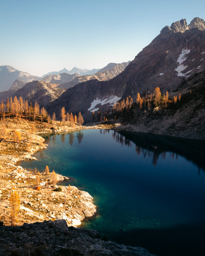
Wing Lake
12 miles round trip | ~3,000 ft gain
Why it works: High alpine basin with dense larches and strong sunrise potential
Crowd reality: Quieter than Maple Pass, but popular for backpackers in early October
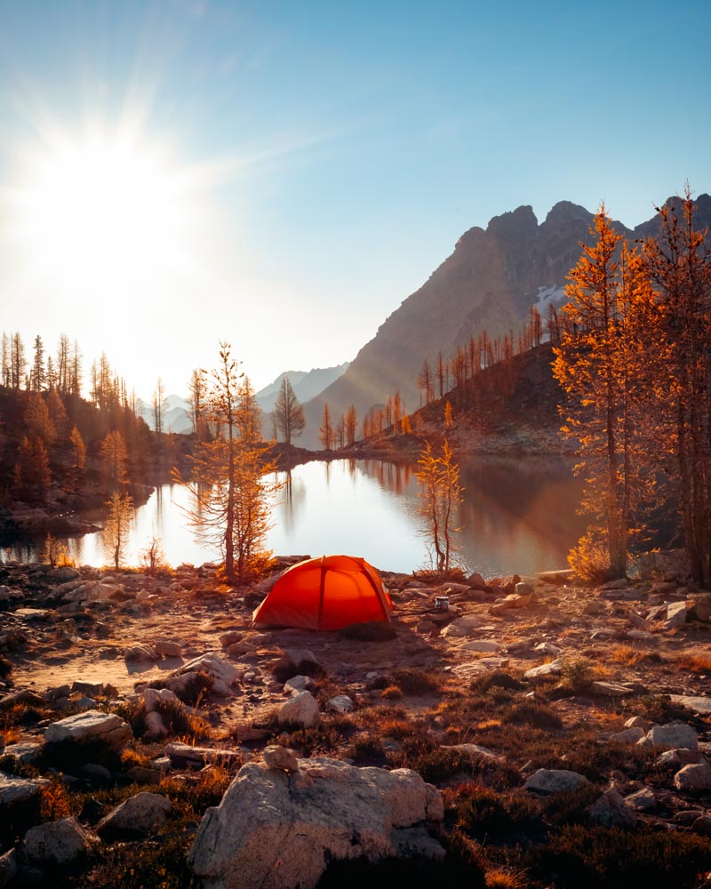
Wing Lake combines a scenic approach, concentrated larches, and the kind of early light that makes the basin feel expansive. It’s my top choice for a larch-season backpacking trip — far enough to thin day hikers, but not so remote that it feels complicated.
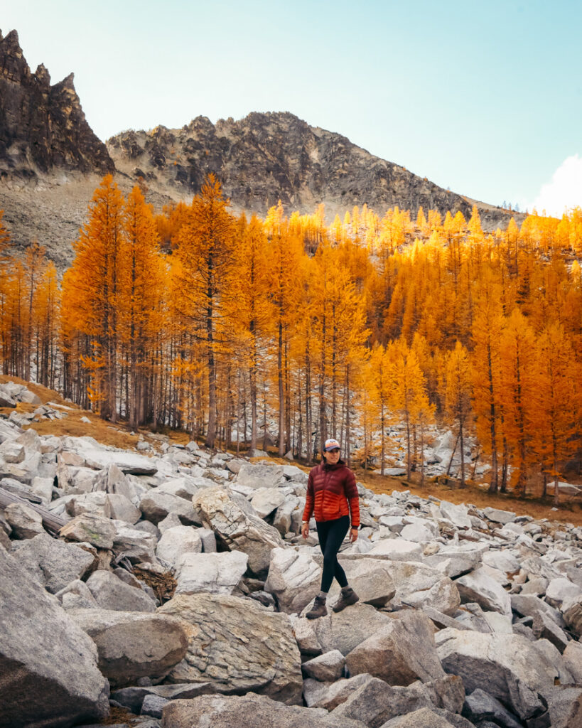
From Rainy Pass, follow the Maple Pass Loop counterclockwise for about 1.25 miles, then turn right toward Heather Pass. After Heather Pass, the route traverses a long boulder field before reaching Lewis Lake. It’s slower going here — follow cairns and stay right where a clearer path appears through sections of the rock.
From Lewis Lake, the final climb gains about 1,100 feet to Wing Lake. It’s steep but straightforward, and the basin opens up gradually as you approach.
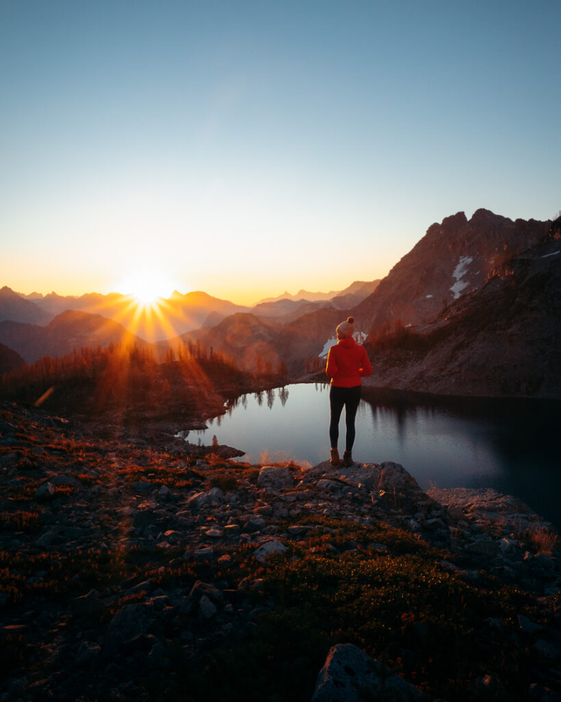
For sunrise, I like walking 15–20 minutes uphill toward Black Peak Pass. From there, light moves across the basin and into the larches as the sun clears the ridge. Wing sits just below 7,000 feet, with Black Peak rising above it.
If you have extra energy, you can continue toward Black Peak Pass for closer views of the north face. It adds distance and elevation, and weather shifts quickly up here, so choose your timing carefully.
Backpacking is permitted without a park lottery since this is National Forest land. Camp on durable surfaces away from the shoreline to protect the basin. Water is available from the lake and nearby streams — I bring a water filter and refill as needed.
Quick logistics:
Park at Rainy Pass | No permit required for backpacking | Expect slower travel across the boulder field
Lewis Lake
6–7 miles round trip | ~1,500 ft gain
Why it works: Shorter alternative to Maple Pass with strong larch scenery
Crowd reality: Quieter than the main loop, though still busy on peak weekends
Lewis Lake branches off the Maple Pass Loop and sits somewhere between Maple Pass and Wing Lake — close enough to share the same basin, but far enough to feel like its own destination.
It’s not just a detour. It’s a place you can plan around.
Park at Rainy Pass and begin counterclockwise on the Maple Pass Loop. After about 1.25 miles, turn right toward Heather Pass. The spur to Lewis Lake branches off shortly after. The final approach crosses open meadow and a stretch of boulder field. It slows the pace and requires some light route awareness — follow cairns and worn footpaths.
For some hikers, that boulder section is the hardest part. For others, it’s part of the fun.
Once you reach the lake, the basin feels contained and quiet. Larches wrap the shoreline and reflect into the water on calm mornings. It’s a good place to stop, have lunch, walk the perimeter, or even take a cold swim on a warm fall day. You don’t have to keep climbing toward Wing Lake for it to feel complete.
If you’re comfortable navigating beyond established trail, Lewis can also serve as a stepping stone toward Wing Lake — but it doesn’t need to be.
It stands fully on its own.
Quick logistics:
Park at Rainy Pass | Northwest Forest Pass required | Light route-finding near the meadow and boulder field
Cooney Lake
8–9 miles round trip (via Foggy Dew) | ~2,200 ft gain
Why it works: Dense larch forest with the option to continue toward Angel’s Staircase
Crowd reality: Moderate in peak season, busier via Foggy Dew on weekends
Cooney Lake sits along the Golden Lakes Loop and offers one of the more concentrated larch experiences in the state — especially if you continue past the lake toward Angel’s Staircase.
As a standalone hike, Cooney feels substantial but manageable. You climb steadily through forest and open slopes before reaching the lake, where larches begin to cluster more tightly.
If you have the energy, continue about half a mile beyond Cooney toward Horsehead Pass. From there, looking back across the basin gives you a broader perspective of the surrounding slopes. This stretch is what gives Angel’s Staircase its name — layered ridges with larches stepping upward across the hillside.
There are two primary access routes.
Via Foggy Dew, the approach is more scenic and generally preferred.
Via Martin Creek, the grade is more gradual, though the lower miles are less distinctive.
Cooney can also serve as a shorter introduction to the full Golden Lakes Loop. Connecting Cooney to Eagle Lakes via Horsehead Pass creates a long, high-elevation traverse with sustained larch coverage — but it requires strong fitness and either two vehicles or a shuttle plan.
Backpacking is permitted at established sites near the lake.
Quick logistics:
Northwest Forest Pass required | Two main access routes (Foggy Dew or Martin Creek) | Camping permitted at established sites


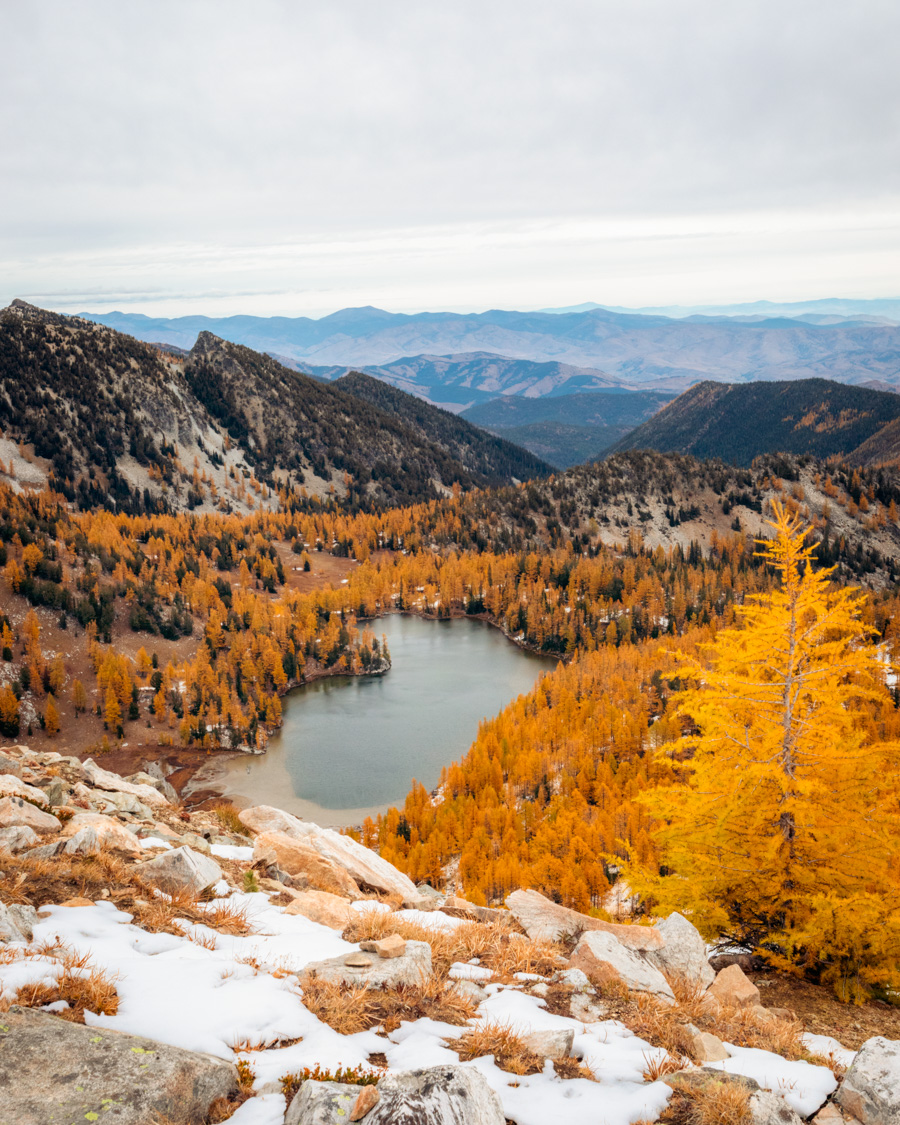
Crater Lakes
6–7 miles round trip | ~1,600 ft gain
Why it works: Strong larch scenery with a gentler grade than nearby basins
Crowd reality: Often quieter than Eagle or Golden Lakes access points
Crater Lakes sits near the Golden Lakes corridor but sees less traffic than its neighbors. The grade is steady and approachable, which makes it a good option for mixed-ability groups who still want strong alpine scenery.
The official trail ends at the lower lake. It’s pleasant, but if you have the time, continue another 10–15 minutes to the upper lake. That basin holds a denser concentration of larches and feels more enclosed by the surrounding slopes.
Walking toward the back of the upper lake brings you closer to the steep mountainside where larches cluster thickly across the hillside. In still conditions, reflections across the water add another layer to the scene.
Compared to Eagle Lakes, the climb feels slightly more gradual, though you still gain meaningful elevation. It’s a solid balance of effort and payoff.
Backpacking is permitted at established sites near the upper lake, and stronger hikers can link this with Eagle Lakes for a longer loop.
Quick logistics:
Northwest Forest Pass required | Established campsites near upper lake | Access via the same general corridor as Eagle Lakes
Carne Mountain
7–8 miles round trip | ~3,600 ft gain
Why it works: Steep climb into one of the densest larch basins in the state
Crowd reality: Moderate — the elevation gain keeps numbers down
I put off Carne Mountain for a few seasons because of its reputation for steep climbing. It’s true — the trail gains elevation quickly. But the payoff comes earlier than most people expect.
The climb starts almost immediately and doesn’t ease much. Within the first couple of miles, larches begin appearing in clusters. By the time you reach Carne Basin, the landscape opens into wide meadows layered with gold.
If you’re unsure about the full summit push, the basin itself makes a satisfying turnaround point. You still get expansive views and a strong concentration of larches without committing to the final climb.
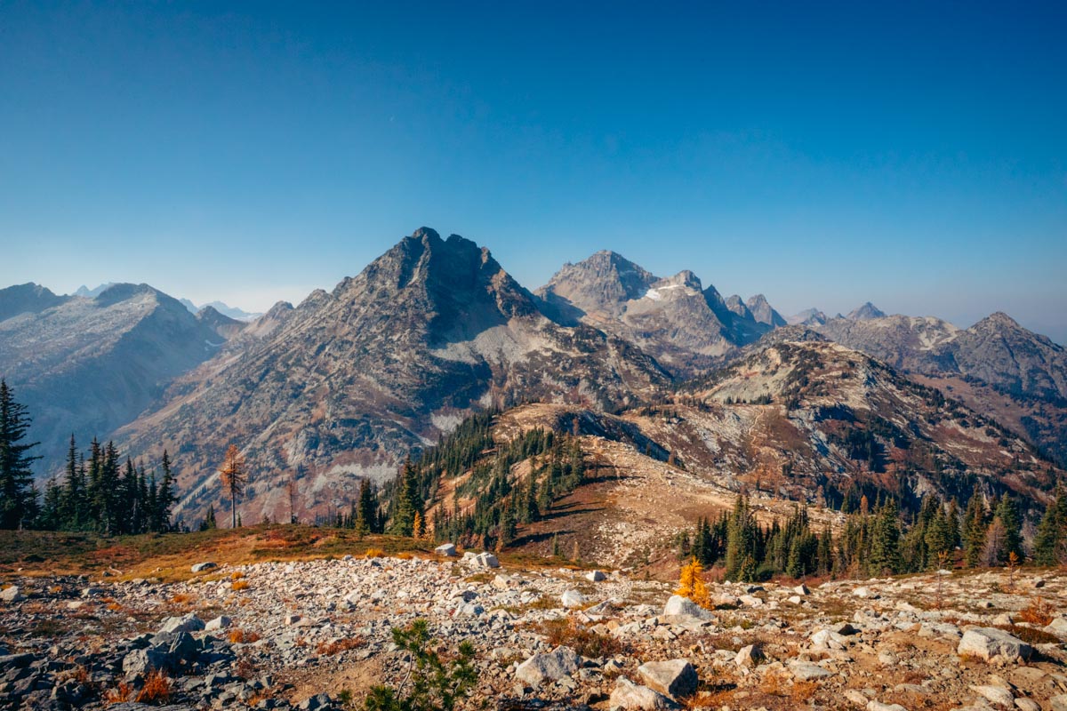
Continuing to the summit adds more elevation but rewards you with broad, uninterrupted views — Glacier Peak, Mount Stuart, and on clear days, even Mount Rainier far to the south. The terrain feels big up there.
The road to the trailhead is rough in places but generally manageable with careful driving.
Quick logistics:
Access via NF-6701 from Highway 2 | Northwest Forest Pass required | Expect sustained climbing from the start
Sunrise Lake (Sawtooth Wilderness)
10–13 miles depending on route | ~2,500–3,000 ft gain
Why it works: Varied terrain with strong larch concentration before the final lake basin
Crowd reality: Generally quieter than Golden Lakes access points
Sunrise Lake stands out because the route keeps changing. You move from forest to waterfalls to open meadows to ridgeline terrain before reaching the lake itself. It doesn’t feel like a single push to a destination — the scenery builds in stages.
Around mile four, you pass through Merchants Basin, where larches cluster densely across the slopes. Many hikers linger here, and for good reason — the concentration is strong and the basin feels expansive.
Continuing to Sunrise Lake adds another shift in perspective. The lake sits in a broader alpine setting, with larches stepping up the surrounding hillsides and more open views.
There is also a loop option that returns via Sunrise Lake Trail, creating roughly a 13-mile circuit. The loop section is rougher and less maintained, so it’s best suited for hikers comfortable with variable tread.
This area is exposed in sections, and weather can shift quickly at elevation. This area is exposed in sections, and weather can shift quickly at elevation. I bring a packable rain jacket here even if the forecast looks stable.
Quick logistics:
Northwest Forest Pass required | Loop option available | Expect variable trail conditions on loop section
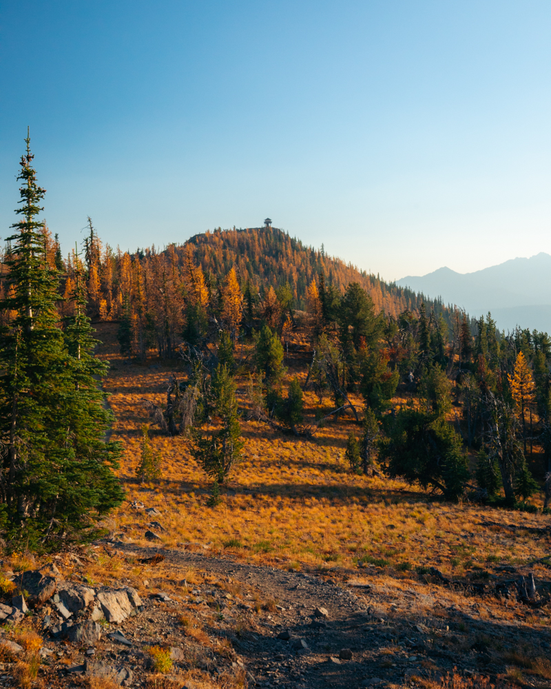
Goat Peak
3.5–4 miles round trip | ~1,400 ft gain
Why it works: Short climb to a fire lookout surrounded by larches and wide sunset views
Crowd reality: Generally manageable, busier on fall weekend afternoons
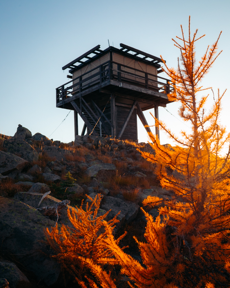
Goat Peak is one of those hikes that feels generous. The drive up the valley is scenic, the climb is steady but not punishing, and the payoff comes quickly.
From the trailhead, the route climbs through forest before opening onto a ridgeline dotted with larches. The final half mile feels especially open, with views stretching across the Methow Valley and into the surrounding peaks.
At the top sits a historic fire lookout, which adds a tangible focal point to the summit. Depending on the season and staffing, it may be open or actively manned. Even when it’s closed, the structure gives the summit a sense of place that’s different from most larch hikes.
This is one of my favorite spots for late-afternoon light. The larches catch the sun as it lowers over the valley, and the ridgeline glows warmly without requiring a massive day. If you plan to linger for sunset, bring a headlamp for the descent.
It’s short enough for strong kids and rewarding enough for experienced hikers who don’t feel like committing to a longer basin hike.
Quick logistics:
Access via FR 52 and FR 5225 near Mazama | Northwest Forest Pass required | Road generally passable for most vehicles

Copper Glance Lake
8–9 miles round trip | ~2,500 ft gain
Why it works: Emerald-green alpine lake framed by larches and rugged peaks
Crowd reality: Quiet — rougher trail keeps numbers lower
Most alpine lakes in Washington lean blue. Copper Glance stands out for its green tint, created by glacial sediment washing down from the surrounding peaks. In larch season, the contrast between the emerald water and golden slopes feels distinct from the usual alpine palette.
The trail is steeper and rougher in sections, with a few stream crossings that can require attention earlier in the season. The final approach crosses a boulder field before the lake comes into view. Trekking poles help on both the climb and the uneven rock.
When you reach the shoreline, the color shift is immediate. It’s a different tone than most North Cascades lakes, and the larches surrounding it amplify that contrast.
Afternoon light tends to reduce glare on the water’s surface. Walking toward the outlet area opens broader compositions that combine the lake, larches, and surrounding peaks.
For hikers comfortable with off-trail travel, a scramble route continues into the upper basin for additional larches and more isolation. This extension requires solid route-finding and mountain judgment.
Quick logistics:
Northwest Forest Pass required | Expect rough trail and boulder travel | Stream crossings early season


Wish List Larch Hikes in Washington
These are on my 2026 larch-season wish list — hikes I haven’t done yet, but that keep showing up in fall trip reports from hikers I trust. Some require longer approaches or rougher access roads, and a few are simply bigger days than I’ve been able to fit in. But they’re firmly on my radar, and if you’re building out future October plans, they’re worth knowing about.
Libby Lake (Chelan–Sawtooth Wilderness)
~9 miles round trip | ~3,000 ft gain
High in the Sawtooth Range at roughly 7,600 feet, Libby Lake sits in a stark alpine bowl beneath Hoodoo Peak. The approach moves through multiple vegetation zones before opening into a high basin where larches reportedly cluster against talus slopes and exposed ridgelines.
Why it’s on my list: It consistently comes up as a quieter, high-elevation larch basin with a wild feel. The combination of elevation, exposure, and remoteness makes it feel more intentional than spontaneous.
Stiletto Lake (North Cascades National Park)
~9 miles round trip | ~3,000 ft gain
Permit note: Overnight camping requires a North Cascades National Park backcountry permit
Stiletto Lake sits deeper within North Cascades National Park, surrounded by dramatic cliffs and alpine terrain. Reports consistently mention strong larch color in a basin that sees fewer hikers than the Highway 20 corridor.
Why it’s on my list: It sounds like a more committing alternative to Blue Lake or Maple Pass — the kind of place you plan for rather than squeeze in between other hikes.
Snowy Lakes (Golden Horn Area, North Cascades)
~18 miles round trip (from Rainy Pass) | ~3,000+ ft gain
Following the Pacific Crest Trail north from Rainy Pass through Cutthroat Pass, Snowy Lakes sit below Golden Horn and Tower Mountain. The approach is long but scenic, with multiple elevation bands that can hold larches during peak season.
Why it’s on my list: The mileage seems to naturally filter crowds. For backpackers especially, it appears to offer sustained alpine scenery with strong fall color away from the busiest trailheads.
Ice Lakes (Glacier Peak Wilderness)
~15 miles round trip (via Carne–Leroy High Route) | ~4,500 ft gain
Ice Lakes lie high in the Glacier Peak Wilderness, accessed via a rugged high route near Carne Mountain. The approach is known for sustained climbing and alpine exposure before reaching a basin dotted with lakes and larches.
Why it’s on my list: Everything I’ve read makes it clear this one is an objective, not a casual weekend hike. The effort appears substantial, but so does the payoff.
Star & Oval Lakes (Chelan–Sawtooth Wilderness)
15–20 miles round trip (depending on approach) | ~3,500+ ft gain
Star Lake sits at roughly 7,400 feet in open Chelan–Sawtooth terrain, with options to continue toward Oval Lake or surrounding peaks. The area is known for broad alpine slopes and high, widely spaced larches.
Why it’s on my list: It looks like a full-immersion alpine experience — high, open, and expansive rather than enclosed in a tight basin.
Larch Lake (Chiwaukum Mountains, near Stevens Pass)
~10 miles round trip | ~3,200 ft gain
Tucked into the Chiwaukum Mountains near Stevens Pass, Larch Lake sits in a basin reportedly filled with subalpine larches. The approach gains elevation steadily before opening into a high lake setting.
Why it’s on my list: The name alone makes it hard to ignore. It’s closer to the Seattle side of the Cascades than many Sawtooth options, and it’s frequently mentioned as a strong fall destination.
Esmeralda Basin (Teanaway, near Lake Ingalls)
6–7 miles round trip (depending on route) | ~1,500–2,000 ft gain
Esmeralda Basin offers rolling meadows and larch-dotted slopes in the Teanaway region. Compared to Lake Ingalls, the grade is more gradual and the terrain more forgiving.
Why it’s on my list: I loved Lake Ingalls, but it’s no secret how crowded it can get. Esmeralda Basin is often recommended as a more relaxed alternative with similar fall color and the option to extend toward Fortune Creek Pass or Fortune Peak.
Larch Season Gear That Actually Matters
You don’t need special equipment for larch hikes. But October adds a few variables.
Layering system A merino base layer plus a lightweight puffy handles freezing trailheads and sunny ridgelines. A packable rain jacket doubles as wind protection. Don’t forget a merino beanie and lightweight gloves — October mornings above 6,000 feet are no joke.
Trekking poles Helpful on steep descents (Carne, Cutthroat) and uneven terrain like the Wing Lake boulder field. I use Black Diamond Alpine Carbon Cork — the cork grips absorb sweat and mold to your hands over time.
Microspikes (after early October) Shaded basins and north-facing switchbacks can ice up quickly once overnight lows drop.
Headlamp Sunset hikes and early starts are common in larch season. Daylight disappears faster than you think. The Black Diamond Spot 400 is bright enough for predawn starts without being overkill.
Water filter Most alpine basins have reliable water sources. A Sawyer Squeeze lets you carry less weight and filter on the go.
Neck gaiter A Buff CoolNet works as sun protection on warm traverses and a neck warmer when the wind picks up at the pass.
How I Track Peak Larch Season
Larch timing shifts slightly every year. Elevation matters more than the calendar.
High basins (6,500–7,500 ft) usually turn first — often late September into early October. Lower lakes and passes hold color a little longer.
About two weeks before a hike, I start checking recent trip reports on WTA and AllTrails. A few days out, I sort Instagram posts by “recent,” not “top,” to see what the color actually looks like in real time.
Freezing levels and incoming storms matter more than anything. One wind event or early snow can shorten the season quickly at higher elevations.
If you have flexibility, watch weather patterns — not just dates.
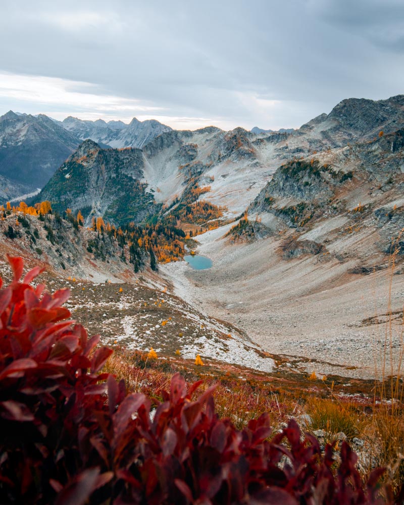
October Realities in the Alpine
October brings shorter days, colder mornings, and the first winter storms. A trail that feels dry and straightforward in September can hold ice in shaded sections by early October.
I always carry a headlamp, a warm layer, and microspikes once freezing levels start dropping. Cell service is unreliable at elevation, so I plan accordingly and share my itinerary before heading out.
Final Thoughts
Larch season is short. Sometimes only two good weekends.
You can chase the most famous basins. You can seek quieter ridges. Or you can return to the same lake year after year and notice how the light changes.
The trees will turn whether the trail is crowded or empty.
What matters most is being there while they’re still glowing.
Continue Your Washington Hiking Journey
If you’re planning more Washington hikes, these guides pair well with larch season: