Mount Rainier Hikes I’d Recommend to a Friend
Mount Rainier isn’t a place you casually squeeze into a day — it’s big, varied, and can feel overwhelming if you don’t know where to start. I’ve lived in Washington for over 20 years, and this mountain has always been part of home for me — something I return to in different seasons, with different people, for different reasons.
With more than 260 miles of trails, Mount Rainier National Park offers everything from short, family-friendly walks to demanding alpine hikes with serious elevation gain. You can chase waterfalls, wander wildflower meadows, hike ridgelines, or watch the sun drop behind the peaks — sometimes all in the same day.
This guide is how I’d help a friend plan their first (or fifth) trip here. The hikes are grouped by effort so you can quickly find one that fits your day, with quick notes on where each trail is in the park and when it’s at its best. No pressure to do it all — just a way to find the right hike for you.
How the Park Is Laid Out (and why it matters)
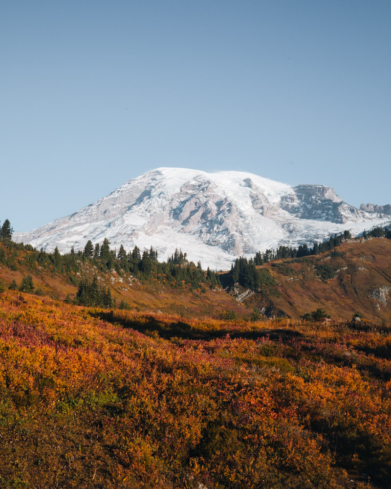
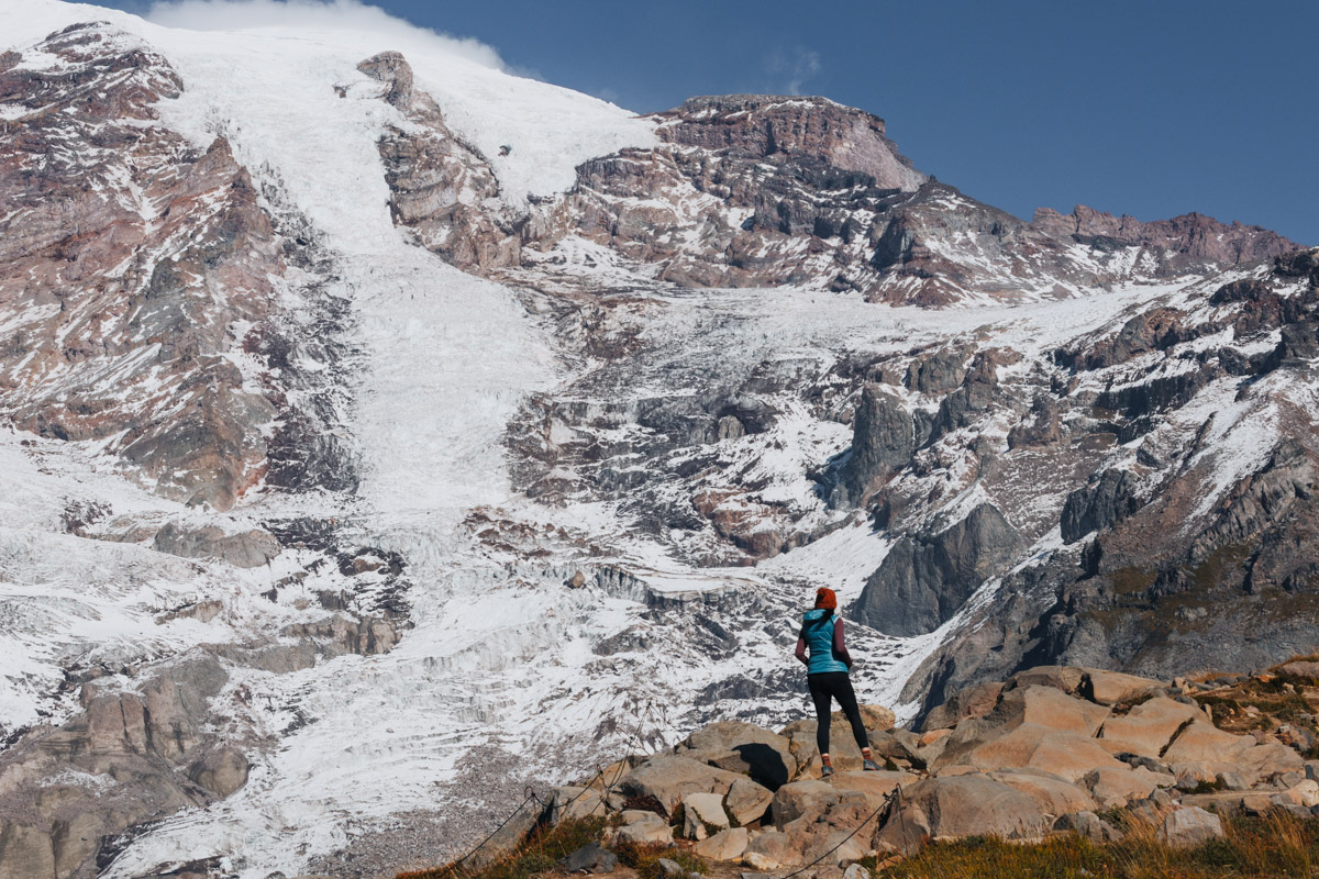
Most people picture Mount Rainier as Paradise — and yes, Paradise is iconic. But Rainier isn’t one place. It’s a massive loop of very different areas spread around the mountain, and where you go has a big impact on crowds, scenery, and the kind of hike you’ll have.
Understanding the layout is often the difference between sitting in a long entrance line… or finding yourself on a quiet trail wondering how it can feel this remote in a national park.
Paradise (Southwest)
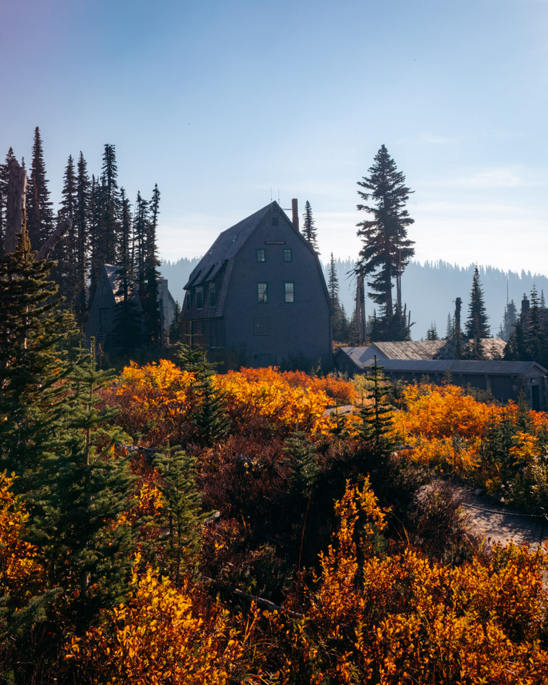
This is the classic Rainier experience: wildflower meadows, the historic Paradise Inn, Skyline Loop, Myrtle Falls. If you’ve seen a postcard of Rainier, it was probably taken here.
Paradise is also the busiest area of the park, especially during peak summer weekends. When conditions are good, though, it really is spectacular.
Best for: first-time visitors, wildflowers, winter snowshoeing
Key hikes: Skyline Loop, Comet Falls, Myrtle Falls
Sunrise (Northeast)
This is my favorite part of the park.
You start at over 6,400 feet — the highest point you can drive to in Mount Rainier National Park — which means you’re immediately in open alpine terrain. Big views show up early, and sunset hikes here are some of the best anywhere in Washington.
Sunrise also tends to feel quieter than Paradise, especially later in the day. The tradeoff is a shorter season: the road opens later and closes earlier depending on snow.
Best for: sunset hikes, big alpine views, fewer crowds
Key hikes: Fremont Lookout, Burroughs Mountain, Summerland to Panhandle Gap

Mowich Lake / Carbon River (Northwest)
This side feels wilder — and it earns that reputation.
Access is rougher and services are limited, which keeps crowds down. When it’s accessible, this area offers some of the most rewarding hiking in the park, including Tolmie Peak.
Access here changes often, so always check current road and bridge conditions before planning a trip on this side.
Best for (when accessible): solitude seekers, backpackers
Key hikes: Tolmie Peak, Spray Park
Ohanapecosh (Southeast)
Ohanapecosh feels completely different from the rest of the park — lower elevation, heavily forested, and noticeably cooler in summer.
It’s all old-growth trees, mossy ground, rivers, and waterfalls. On hot August days when Paradise feels crowded and exposed, this side can feel like a quiet refuge.
Best for: families, hot days, shaded hikes
Key hikes: Grove of the Patriarchs
List of Must-Do Hiking Trails Mount Rainier National Park
Below are the Mount Rainier hikes I recommend most, ordered by effort so you can quickly find one that fits your time, energy, and season.

Easy hikes (low effort, high reward)
Suntop Lookout
~1 mile round trip (or drive almost to the top) · ~450 ft gain if hiking · Easy · Near Crystal Mountain / outside the park
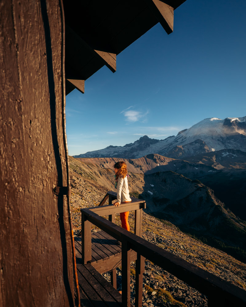
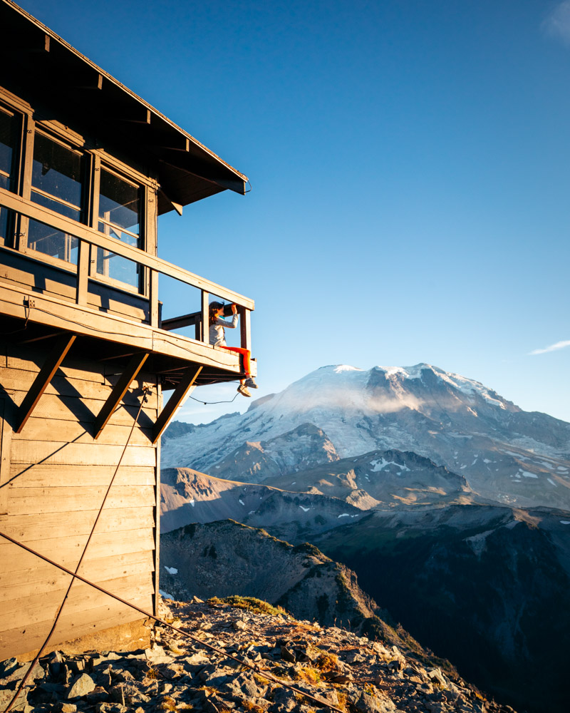
This “hike” is technically outside Mount Rainier National Park, but it’s one of the easiest ways to get big views with almost no effort. The road takes you nearly to the top, and from there it’s a short walk—about 50 feet—to the fire lookout itself.
In summer, a volunteer often lives in the lookout, which makes the experience feel surprisingly special. If they’re there, you can usually step inside, take a look around, and hear a bit about how these historic towers are maintained and what life is like spending the season up here. It adds a human touch to what’s already a beautiful spot.
Suntop is best known for sunset views over the Cascade Range, especially in late summer and early fall when the light turns warm and the crowds thin out. It’s an easy win if you’re short on time, traveling with kids, or just want something low-key after a bigger hike.
This is also a great hike to pair with Grand Park—they’re close together, and Suntop works perfectly as a quick stop either before heading home or as a sunset capstone after a longer day on the trail.

Grove of the Patriarchs
~1.1 miles round trip · ~50 ft gain · Easy · Ohanapecosh area · Best June–October
Grove of the Patriarchs is a short, shaded loop through ancient old-growth forest in the Ohanapecosh area, and it’s one of the easiest ways to experience the quieter, greener side of Mount Rainier. The trail crosses a suspension bridge over the river and then winds through towering cedars and firs on a flat, well-built boardwalk.
The bridge is half the fun. It’s the kind of place where it’s easy to linger—skipping rocks in the water, sitting by the river, or letting kids wander a bit on their own without worrying about steep drop-offs or long distances. This is a hike where moving slowly actually feels like the point.
It’s especially good on hot summer days when higher-elevation trails feel exposed, and it works well for a wide range of people—young kids, grandparents, or anyone looking for something low-effort but still memorable. If you want a calm, unrushed walk that feels very different from Rainier’s big alpine hikes, this one fits beautifully.

Naches Peak Loop
~3.5 miles round trip · ~700 ft gain · Easy–moderate · Chinook Pass / outside the park · Best July–September
Naches Peak Loop is one of those rare hikes that truly works for almost everyone. The first time I did it, it was a multi-generational day: young kids, my mom in her 60s, and plenty of time to stop, snack, and take it all in without feeling rushed or overwhelmed.
The payoff-to-effort ratio here is hard to beat. You get steady views of Mount Rainier, open meadows that explode with wildflowers in late summer, and a gentle loop that never feels punishing. It’s easy enough for kids to stay happy, but scenic enough that it still feels special.
One of the best things about Naches Peak is its location. Sitting near Chinook Pass, it’s outside the main park entrances, which means you can often skip long entrance lines while still getting peak wildflowers and classic Rainier views. Sunset by Tipsoo Lake is especially beautiful if you time it right.
This is a hike I’ve returned to again and again over the years—for quick trips, family outings, or days when you want something memorable without committing a full day to the trail.

Moderate hikes (worth the effort)
Comet Falls
~3.8 miles round trip · ~1,400 ft gain · Moderate · Longmire area · Best May–July
Comet Falls was one of those hikes I drove past for years before finally stopping to do it—and I was genuinely surprised by how good it was. The trail starts gently, crossing a wooden footbridge that sets the tone early on, before climbing steadily through the forest toward the sound of rushing water.
Before you even reach Comet Falls, there’s another waterfall along the way that stopped me in my tracks. The light was hitting it just right, and it felt like the kind of moment you don’t expect on a hike you almost skipped.
Comet Falls itself is loud and powerful. The spray is intense, rainbows often form in the mist, and the scale of it feels unmistakably Rainier—big, physical, and impossible to ignore. During spring melt, especially in May and June, the force of the water is impressive.
There’s more trail beyond the falls if you want to keep going, but even turning around here feels completely worth it. This is a solid choice if you want something dramatic without needing a full day or a long drive deeper into the park.

Fremont Lookout
~5.6 miles round trip · ~900 ft gain · Moderate · Sunrise area · Best July–September
Fremont Lookout starts high at Sunrise, which means the views show up early and stay with you most of the way. The trail is gently graded and wide for most of the hike, making it feel approachable even though the payoff is big. There is one short section near the lookout with some exposure, but it’s brief and manageable with a little attention—especially if you’re hiking with kids.
This is one of those hikes where the destination almost feels optional. Even if you don’t go all the way to the lookout tower, the last stretch of trail has sweeping views that make it an incredible place to watch the light change in the evening. Sunset comes on slowly here, and it’s easy to linger without feeling rushed.
The lookout itself is a fun place to spend time once you reach it—especially at golden hour. This has been one of my favorite evening hikes with my kids: packing headlamps, taking our time on the way down, and letting the experience stretch into the night rather than treating it like a quick out-and-back. It’s memorable in a quiet, lasting way.
If you’re looking for a hike that delivers classic Rainier scenery without feeling overly demanding, Fremont Lookout fits beautifully—especially for late summer evenings when daylight lingers and the mountain puts on a show.

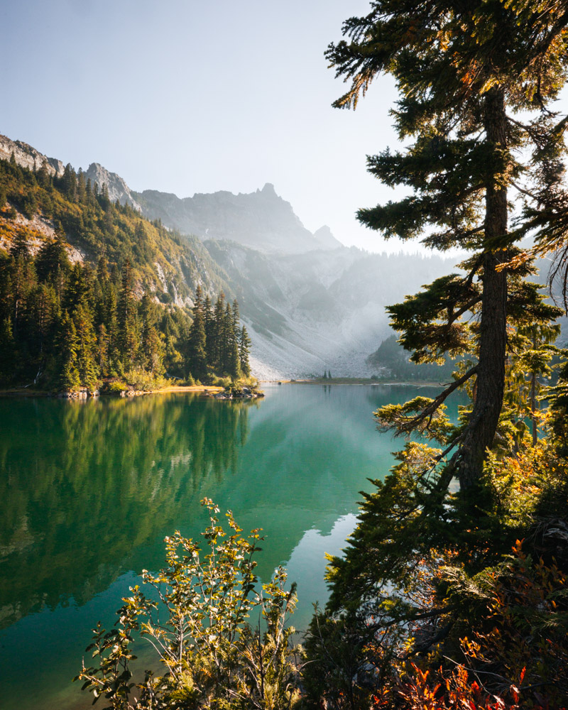
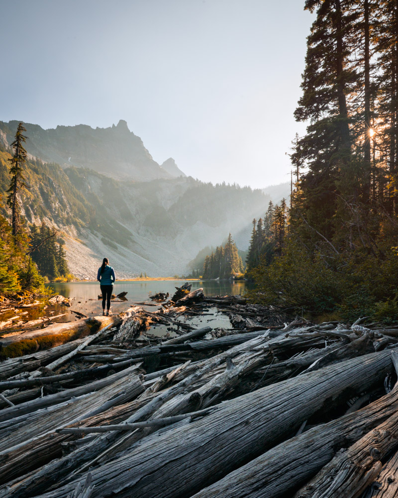
Tolmie Peak
~5.6 miles round trip · ~1,500 ft gain · Moderate · Mowich Lake area · Best late July–August (when accessible)
Tolmie Peak is currently closed and not accessible, which is a real loss—because when it’s open, this hike delivers one of the most striking sunset views in the park. From the lookout, Mount Rainier fills your entire field of vision, and as the light fades, the mountain often shifts through soft pinks and warm tones that feel almost unreal.
When we hiked it, we treated it as an evening outing and took our time getting there. Eunice Lake sits partway up the trail and makes a natural place to pause—kids exploring near the water, shade overhead, and plenty of reasons not to rush. It’s a nice balance to the hike, but the real payoff comes later.
Up at the lookout, the view opens completely. Watching the sun drop from this vantage point feels expansive and unhurried, especially on clear summer evenings when the mountain holds the light for a long time. It’s the kind of place you naturally linger, knowing the walk back will be quiet and dark and that’s part of the experience.
If and when this trail reopens, Tolmie Peak is worth saving for a calm summer evening. Bring a headlamp, plan to stay awhile, and let the sunset do what it does best here.

Grand Park
~5.6 miles round trip · ~700 ft gain · Easy–moderate · Sunrise area (via Enumclaw) · Best July–September
Grand Park is one of the most underrated hikes in Mount Rainier, and that’s part of what makes it so special. The trail opens into an enormous sweep of meadows with uninterrupted views of the mountain, and once you’re out there, it really does feel like a park in the truest sense—wide, open, and unhurried.
In summer, the meadows fill with wildflowers, and in early fall they turn soft gold. The walking itself is gentle once you reach the open terrain, which makes this a surprisingly approachable hike given how big everything feels around you. It’s easy to find your own space here, even during peak season.
I usually recommend continuing on until you reach the edge where the valley opens up, then turning around. That’s where the sense of scale really lands—Rainier feels massive, the landscape stretches in every direction, and the quiet is part of the experience.
The trailhead sits outside the main park entrance near Enumclaw, which means no entrance lines and no fees, though it still feels every bit like a national park hike once you’re out there. If you’re looking for wide-open views without a lot of effort or crowds, Grand Park quietly delivers.

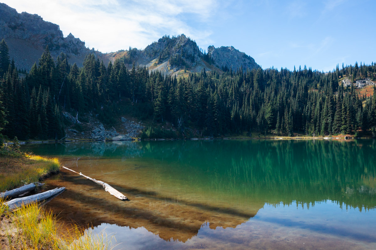
Bench and Snow Lakes
~2.5 miles round trip · ~700 ft gain · Moderate · Paradise area · Best July–October
Bench and Snow Lakes is one of those hikes that doesn’t sound dramatic on paper but ends up being far better than expected. Even though it sits close to Paradise, it feels noticeably quieter, almost like you’ve slipped just far enough away from the crowds without really going anywhere remote.
The trail rolls up and down through forest and open areas, never staying flat for long, which keeps it interesting without feeling overwhelming. Early on, there’s an open stretch where it’s worth turning around—Mount Rainier rises behind you in a way that’s especially beautiful in both summer and fall, with color and texture that change as the season shifts.
The real surprise comes at the lakes. Snow Lake, in particular, is striking in a way that feels unexpected for such a short hike. The water is clear and calm, the setting feels tucked away, and on warm days it’s tempting to jump in. If you’re lucky enough to snag a camping permit, it’s also a memorable place to spend the night.
This is a great option if you want a lot of payoff without a huge time commitment—quiet trails, big views, and a destination that genuinely feels earned. It’s one of those hikes that reminds you how generous Mount Rainier can be if you step just a little off the obvious path.
Hard hikes (commitment required)
Plummer Peak
~2.2 miles round trip · ~1,700 ft gain · Moderate–hard · Paradise area / Tatoosh Range · Best mid-July–October
Plummer Peak is short, steep, and very much worth it. It’s one of those hikes I drove past for a long time before finally stopping, and I’m glad I did. The climb gains elevation quickly, and while your back is mostly to Mount Rainier on the way up, the payoff comes all at once near the top.
From the summit, the views open wide. Mount Rainier fills the skyline, Mount Adams shows up on clear days, and there’s a small tarn near the top that catches the light in a really beautiful way. It’s not the flashiest or most talked-about peak in the area, but that’s part of the appeal—it feels a little quieter, a little less performative.
The descent is where this hike really shines. Once you turn around, Rainier stays right in front of you almost the entire way down, and it’s hard not to stop repeatedly just to take it in. The effort feels justified here in a way that’s very satisfying.
If you’re looking to add more mileage, Pinnacle Peak branches off nearby and makes for a longer outing. But on its own, Plummer Peak is a great choice when you want something steep and scenic without committing to a long day. It’s straightforward, beautiful, and doesn’t try too hard to impress—which somehow makes it better.

Crystal Lakes
~6.6 miles round trip · ~2,300 ft gain · Hard · Crystal Mountain area · Best July–October
Crystal Lakes is a hike that asks a bit more of you, but the payoff is unmistakable once you arrive. The climb is steady and direct, and by the time you reach the lakes, you’re fully in alpine terrain—low shrubs, bright blueberry bushes in late summer and fall, and wide-open mountain views that feel a world away from the trailhead.
The upper lake is the standout. It’s calm, reflective, and genuinely beautiful after the work it takes to get there. On a clear day, the water mirrors the surrounding ridges in a way that makes you want to drop your pack and stay awhile. Even as a day hike, it feels like a destination you’ve earned.
The listed stats take you to the lakes, but you can continue on toward Sourdough Gap if you have the time and energy. I didn’t make it that far on my trip and had to turn around earlier than planned, but even stopping at the lakes felt complete. It’s also the kind of place that plants ideas for future trips—longer routes, backpacking plans, and reasons to come back.
This hike sits firmly on the harder end of the spectrum, but it rewards the effort with classic alpine scenery and a real sense of arrival. It’s not flashy—it’s just very, very good.

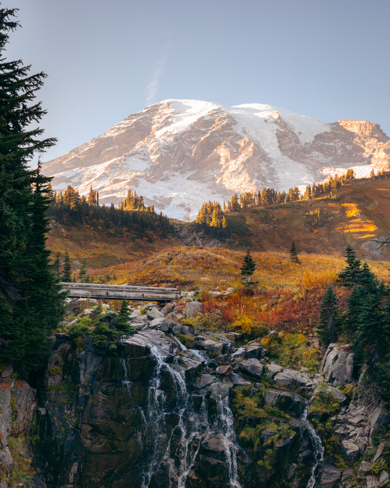
Skyline Loop
~5.5 miles round trip · ~1,700 ft gain · Moderate–hard · Paradise area · Best July–October
Skyline Loop is the hike people point to when they say, “If you only do one hike at Rainier, make it this one.” And while that kind of line usually makes me skeptical, this trail does earn its reputation. It manages to pack a little bit of everything into one loop—big mountain views, wildflower meadows, waterfalls, and a constant sense of being up close to Rainier itself.
Starting from the Paradise area, the trail wastes no time delivering scenery. Meadows fill with wildflowers in late July and August, and in the fall the same slopes soften into warm color. Myrtle Falls is an easy and worthwhile stop along the loop, and it fits naturally into the hike rather than feeling like a separate destination.
Despite how popular Skyline is, timing makes a huge difference. I’ve found that going later in the day—especially toward evening—completely changes the experience. The crowds thin out in a way that’s almost surprising, and as the light drops, the trail feels calmer and more spacious. Sunset up here can be quietly spectacular, and the mountain seems to hold the light longer than you expect.
Skyline is demanding, but it’s also generous. The payoff comes steadily rather than all at once, which makes the effort feel manageable even on a longer day. If you want a hike that truly captures the range of what Mount Rainier offers—and you’re thoughtful about when you go—this one delivers every time.
The Burroughs
~7 miles round trip (to Third Burroughs) · ~1,800 ft gain · Hard · Sunrise area · Best mid-July–September
Burroughs Mountain starts high at the Sunrise visitor center, and it doesn’t take long before you’re fully in alpine terrain. From the first stretch, the views are wide open, and as you move farther along the trail, Mount Rainier feels less like something you’re looking at and more like something you’re walking toward.
You can turn around at Second Burroughs or keep going to Third, and both feel like natural endpoints depending on energy and conditions. The trail stays exposed and expansive the entire way, and that openness is part of what makes this hike so striking—you’re not dipping in and out of forest or breaking the experience into sections. It’s continuous, immersive, and very close to the mountain.
We turned this into a sunset outing by camping at Sunrise, hiking up in the evening, and then coming back by headlamp. Not having to drive afterward completely changed the experience—it felt calmer, easier, and more intentional. Crawling into a sleeping bag after watching the light fade off the mountain was a pretty perfect way to end the day.
As beautiful as it is at any time, Burroughs really shines as a place to be with Rainier rather than just photograph it. The sense of scale is intense, the proximity is real, and standing out there at sunset makes you feel like you’re on the mountain, not just visiting it.

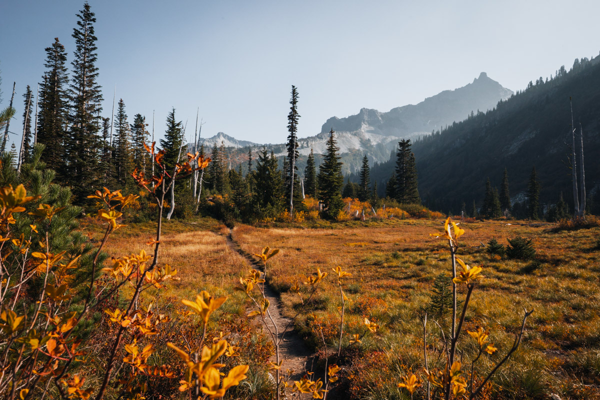
Summerland to Panhandle Gap
~8.5 miles round trip · ~2,500 ft gain · Hard · White River area · Best July–September
View on AllTrails
Summerland to Panhandle Gap is a hike that unfolds slowly, changing character as you go. It starts gently in the forest and then opens into Summerland’s wide meadows—streams cutting through green fields, wildflowers everywhere, and Mount Rainier rising nearby in a way that feels calm and generous rather than overwhelming.
As you continue, the landscape shifts. The trail becomes rockier and more alpine, the colors change, and by the time you reach Panhandle Gap, it feels like you’ve crossed into an entirely different environment. The views open in every direction, and the sense of space up there is huge. It’s one of those hikes where you’re constantly aware of how far you’ve come—not just in distance, but in terrain.
I ended up doing this as an overnight after an injury changed my original plans, and it turned out to be one of those trips that sticks with you. Spending the night at Summerland made the whole experience feel more spacious and unhurried, and it made watching the light change up high feel natural rather than rushed.
This is a hike that rewards time. Whether you do it as a long day or with a permit to stay overnight, the variety alone makes it memorable—from forest to meadow to high alpine in a single outing. It’s a beautiful way to experience just how much Mount Rainier can offer in one trail.

Planning your hike at Mount Rainier
Mount Rainier is a place where conditions matter just as much as mileage. Snowpack, weather, and road access can all shape what’s possible on any given day, and plans often change once you arrive. That’s part of the experience here. The hikes above are spread across different areas of the park for a reason — flexibility is one of the best tools you can bring.
If the mountain is out in the morning, go. If clouds roll in, be willing to pivot. Some of my favorite days at Rainier have come from adjusting plans rather than sticking rigidly to one hike.
Best time to hike Mount Rainier
- Late July–August: Peak wildflowers, full trail access, busiest season
- September: Fewer crowds, cooler temperatures, fall color on some trails
- October: Limited access, but beautiful on clear days if roads are still open
- Spring / early summer: Snow lingers; stick to lower-elevation hikes and waterfalls
Weather and snowpack vary year to year, so always check current conditions before heading out.
Permits, parking, and access
- Most day hikes do not require permits
- Overnight trips require a backcountry permit through the National Park Service
- Roads and trailheads can close suddenly due to weather or damage — always check NPS updates
- An entrance fee is required for areas inside the park; some trailheads sit just outside park boundaries
A note on choosing the right hike
You don’t need to do the biggest or most famous hike to have a great day at Mount Rainier. Some of the most memorable experiences here come from shorter trails, quiet meadows, or timing a hike well rather than chasing mileage.
Pick a hike that fits your energy, the season, and the weather — and leave room to slow down once you’re out there.
More Mount Rainier planning resources
If you’re looking to round out your trip, these guides go deeper into the logistics:
- Where to stay near Mount Rainier National Park
- Best base towns for hiking Mount Rainier
- How to plan your first trip to Mount Rainier National Park